Little Wigwam
✓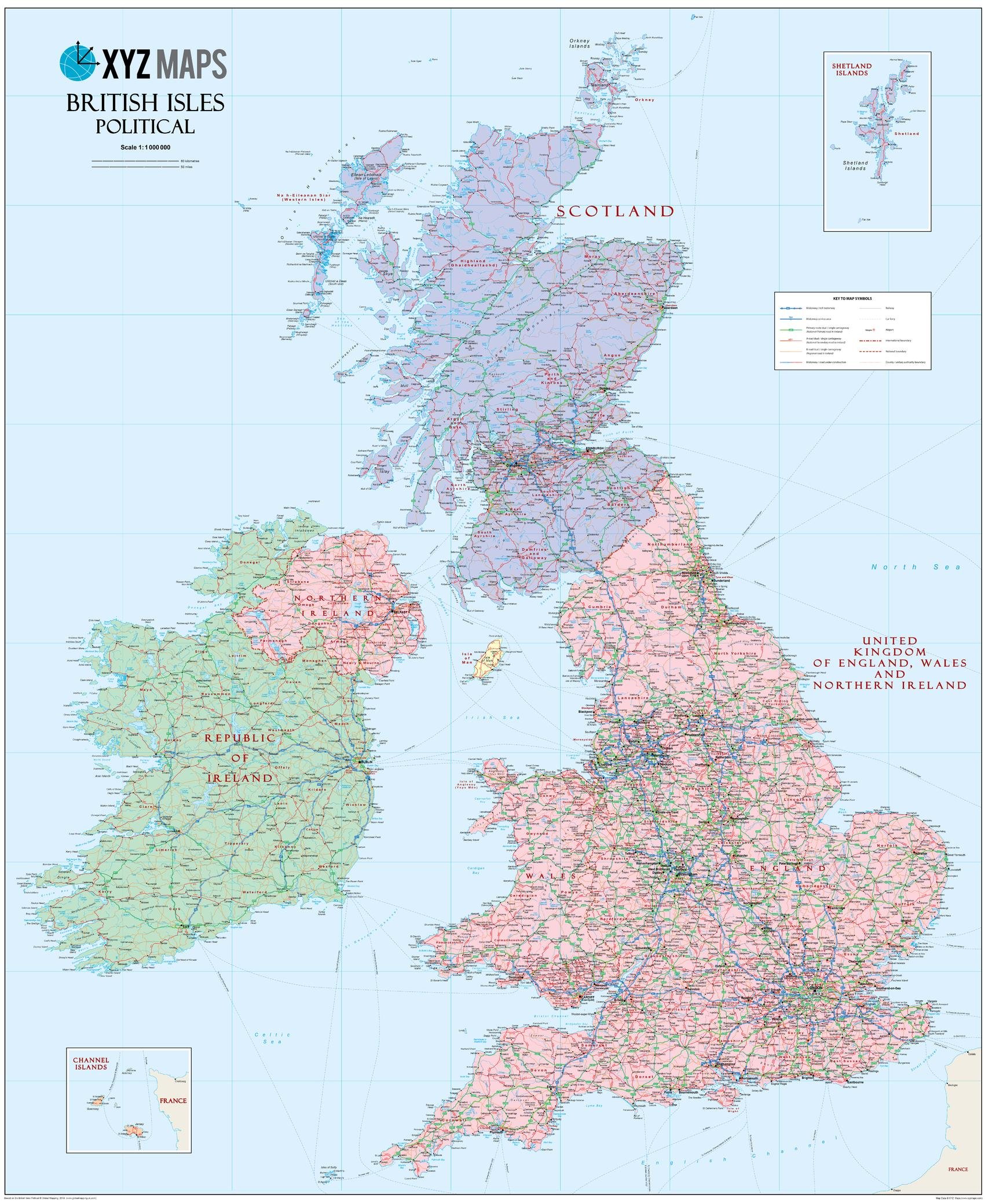
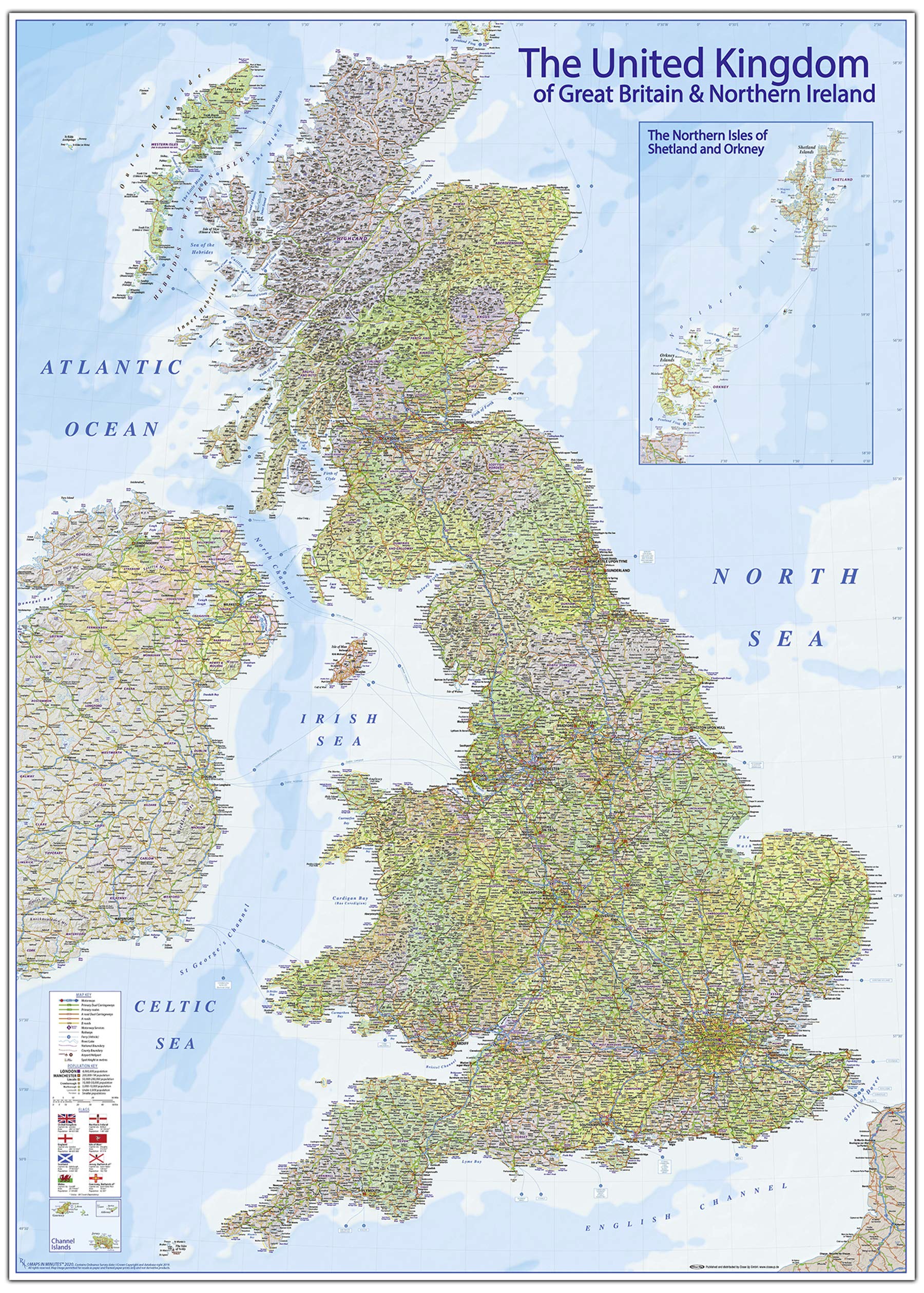
35.5 x 43.5 inches. Laminated. Flat map, tubed for shipping.The Scottish British Isles Political wall map is ideal for the office or educational environment. This unique Scottish British Isles map features political colouring showing the Counties of the United Kingdon of England, Wales & Northern Ireland (rUK), Scotland and Ireland. All major Towns, Roads, Rivers and Lakes are shown on this map. This map shows the British Isles as they would appear if Scotland became independent. If you are a YES supporter in favour of independence for Scotland then this is the map for you!Map created by XYZ Maps, one of Scotland's leading map publishers.Scale 1:1,000,000
Customer reviews
10 Trustpilot reviews total, with 2 shown at a time.
I wrote to Bigamart's customer support and they accompanied the process of reshipping the item until it finally arrived. I felt a genuine effort to solve the problem till it was finally solved.
The package was here in Australia from England in a few days — so quick! Something was missing and they refunded it straight away. Pretty happy with these guys.
You might also like