Little Wigwam
✓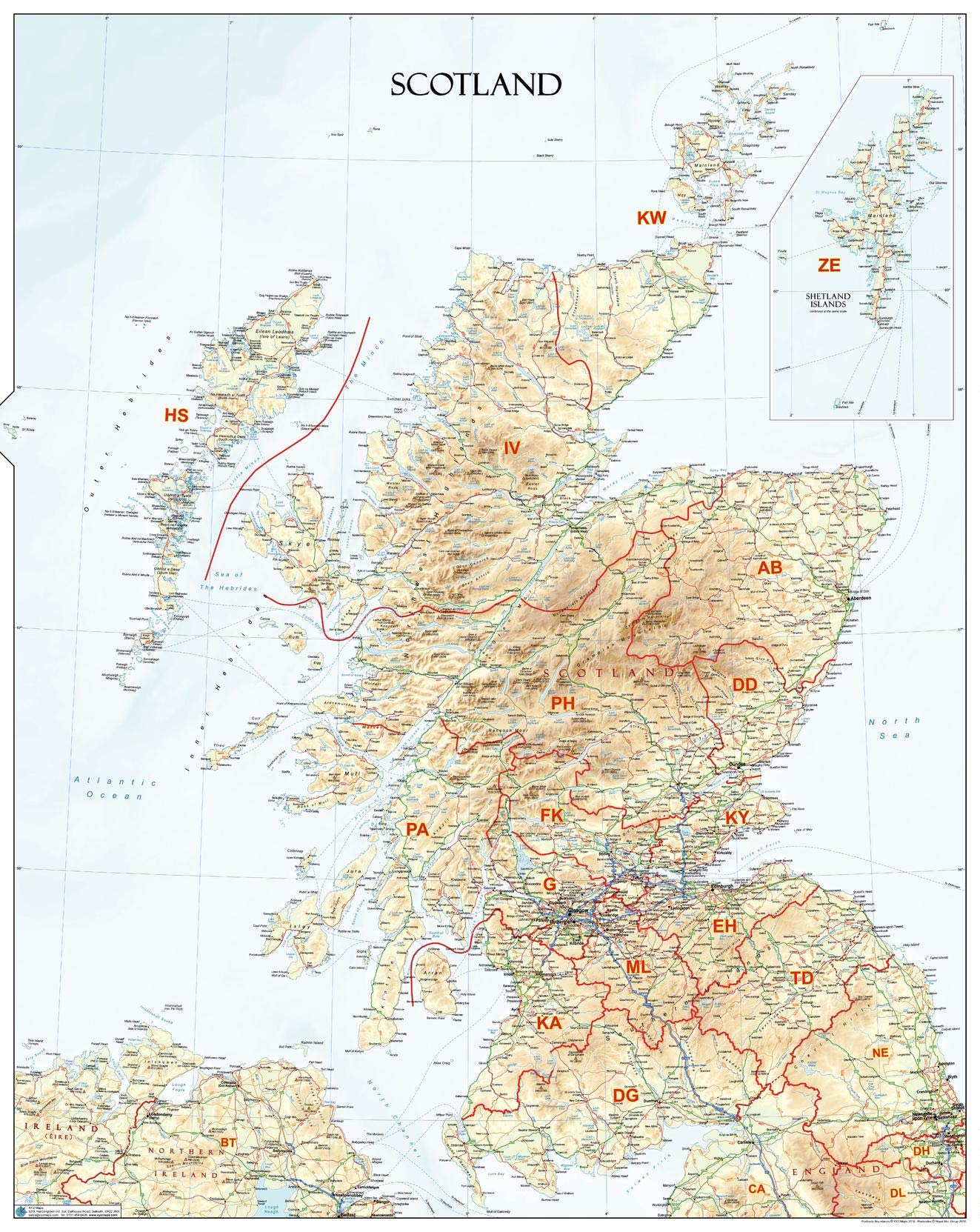
27.75 x 34.75 inches. Laminated. Flat map, tubed for shipping. An informative physical wall map of Scotland ideal for the office or educational environment. This unique map accurately depicts relief. Includes all major towns, roads, rivers, lakes and clearly shows the postcode area boundaries along with the associated postcode Labels. Map created by XYZ Maps, one of Scotland's leading map publishers. Scale 1:650,000
Customer reviews
10 Trustpilot reviews total, with 2 shown at a time.
I wrote to Bigamart's customer support and they accompanied the process of reshipping the item until it finally arrived. I felt a genuine effort to solve the problem till it was finally solved.
The package was here in Australia from England in a few days — so quick! Something was missing and they refunded it straight away. Pretty happy with these guys.
You might also like