Little Wigwam
✓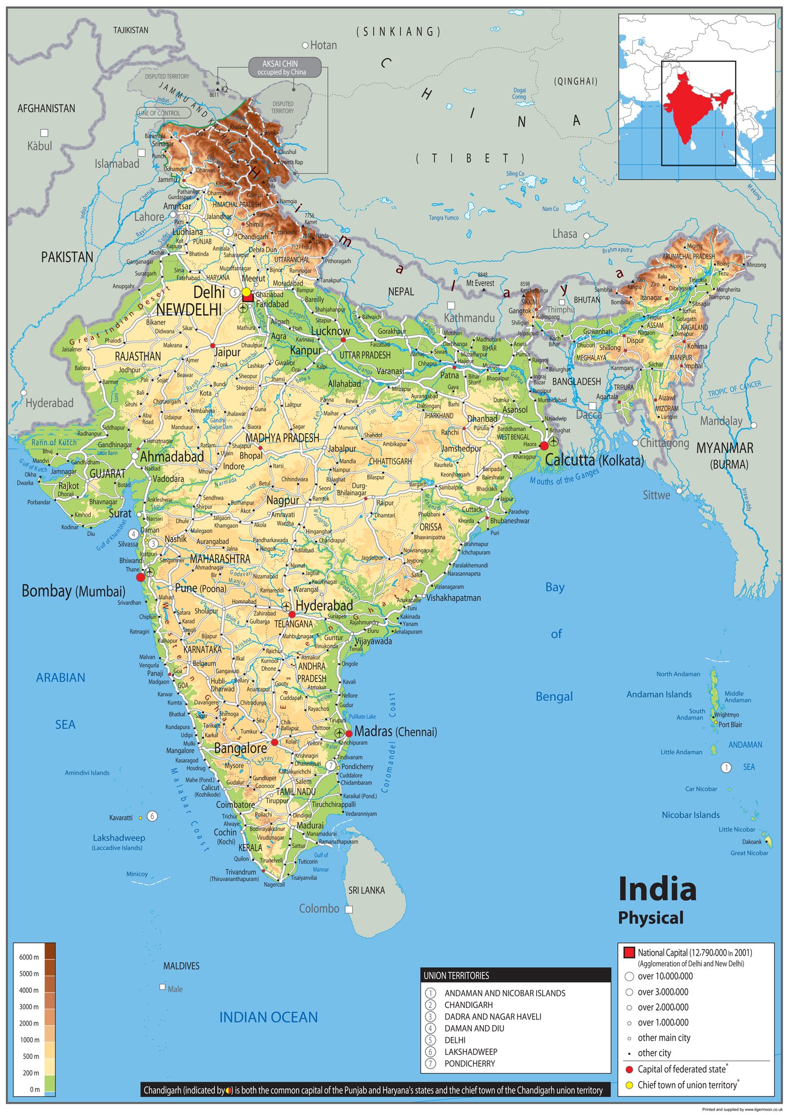
Discover the Republic of India, a country in the of South Asia. India is embraced by the vast Indian Ocean on the south, the Arabian Sea on the southwest, and the Bay of Bengal on the southeast. Its borders are shared with Pakistan to the west, while its northern boundaries connect to China, Nepal, and Bhutan. On the east, India extends its reach towards the lands of Bangladesh and Myanmar. In the Indian Ocean, India is a neighbor to Sri Lanka and Maldives, while its Andaman and Nicobar Islands are surrounded by waters that connect it to Thailand, Myanmar, and Indonesia. Our Physical Map of India is vibrant and informative, with easy-to-read text and bright colours. Including capital cities, rivers, major roadways, towns, surrounding bodies of water and mountain ranges. The physical aspects such as land elevation are clearly showed and makes for an attractive map either for the home, office or school, for display on a wall or for desk work. Size A0 - 84.1 x 118.9 cm. Printed onto high quality poster paper and laminated for durability.
Customer reviews
10 Trustpilot reviews total, with 2 shown at a time.
I wrote to Bigamart's customer support and they accompanied the process of reshipping the item until it finally arrived. I felt a genuine effort to solve the problem till it was finally solved.
The package was here in Australia from England in a few days — so quick! Something was missing and they refunded it straight away. Pretty happy with these guys.
You might also like