Little Wigwam
✓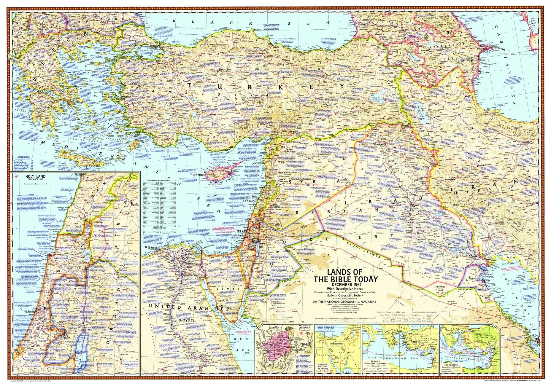
"In Biblical lands long torn by conflict, more than custom prompts the beginning and ending of conversations with that freighted word 'peace'." Published in December 1967 this map accompanied three articles, including "Eyewitness to War in the Holy Land," and outlines the territory occupied by Israel in June of 1967 during the Six Days' War between Israel and neighboring Arab countries. It is a stunningly produced snapshot in time. Featuring crisp mid-century detail and copious historical facts, this map offers a close-up view of four of the countries that make up the Holy Land - Israel, Jordan, Syria, and Lebanon, highlighting the tumultuous relationship these nations had with one another - and continue to have today. Bible passages alongside relevant place names are peppered throughout this map that epitomizes National Geographic's legendary cartographic style. Insets showing the journeys of the Crusades, St. Paul and the routes of the Biblical Exodus reveal this region's importance to western civilization. Further insets of the Walled City of Jerusalem complete this portrait of this fascinating region. This map is drawn in a Conic projection. Historians and Bible scholars must own this attractive map. A perfect companion to the maps of the Holy Land published in 1938,1946 and 1956! Printed on polypropylene, an ideal material for wall maps as the printing brings out rich colours, and crisp edges for readability. The material is stronger than most papers and unlikely to crease or rip. The matte finish eliminates glare, and adds texture to the map. Ideal for display. Your map is rolled and packaged in a sturdy tube to protect it during shipment. "
Customer reviews
10 Trustpilot reviews total, with 2 shown at a time.
I wrote to Bigamart's customer support and they accompanied the process of reshipping the item until it finally arrived. I felt a genuine effort to solve the problem till it was finally solved.
The package was here in Australia from England in a few days — so quick! Something was missing and they refunded it straight away. Pretty happy with these guys.
You might also like