Little Wigwam
✓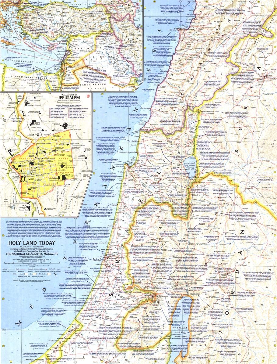
"The tensions that divide so much of the world are dramatized in an unusual feature of the Society's latest map." Published in December 1963 accompanying the articles "Crusader Road to Jerusalem" and "Conquest of the Holy City", this map of the Bible Lands combines the rich history and international influence of the region with contemporary geographic and political realities on a stunningly produced snapshot in time. Featuring crisp mid-century detail and copious historical facts, this map offers a close-up view of four of the countries that make up the Holy Land - Israel, Jordan, Syria, and Lebanon. A key unique feature makes this map an incomparable reference for its time: not a single road or highway crosses the border between Israel and its Arabic neighbors. Bible passages alongside relevant place names are peppered throughout this map that epitomizes National Geographic's legendary cartographic style. This map features an inset showing the Holy Land in context with the larger Middle Eastern region. A unique inset of the Walled City of Jerusalem reveals the fourteen stations marking the way of the cross from Pilate's hall to Calvary. This map is drawn in the Albers Conic Equal-Area projection, which uses two standard parallels between which minimizes distortion, however scale and shape is not preserved. Historians and Bible scholars must own this attractive map. A perfect companion to the maps of the Holy Land published in 1938 , 1946 and 1956! Printed on polypropylene, an ideal material for wall maps as the printing brings out rich colours, and crisp edges for readability. The material is stronger than most papers and unlikely to crease or rip. The matte finish eliminates glare, and adds texture to the map. Ideal for display. Your map is rolled and packaged in a sturdy tube to protect it during shipment.
Customer reviews
10 Trustpilot reviews total, with 2 shown at a time.
I wrote to Bigamart's customer support and they accompanied the process of reshipping the item until it finally arrived. I felt a genuine effort to solve the problem till it was finally solved.
The package was here in Australia from England in a few days — so quick! Something was missing and they refunded it straight away. Pretty happy with these guys.
You might also like