Little Wigwam
✓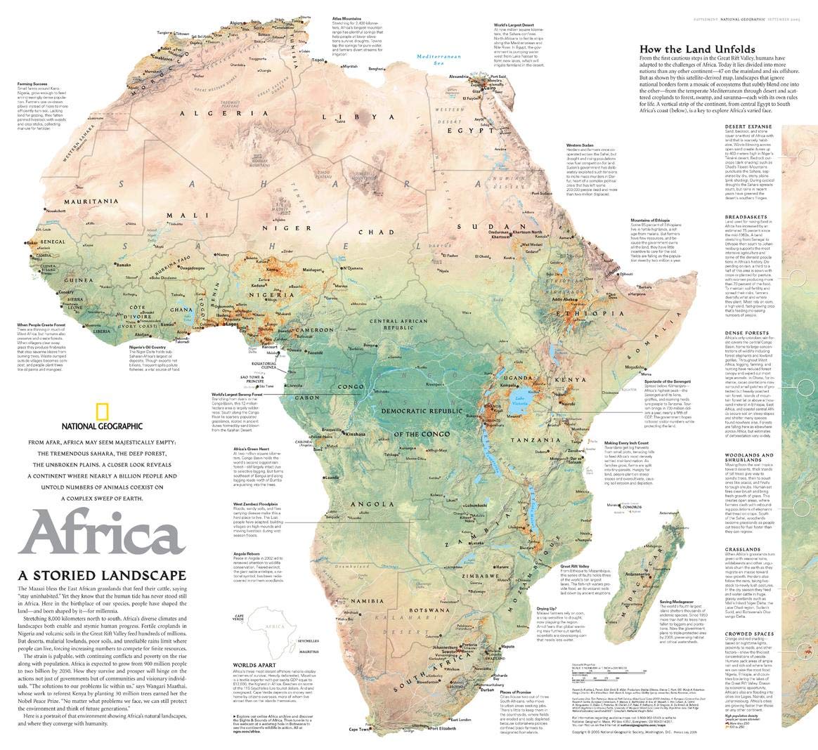
From afar, Africa may seem majestically empty: the tremendous Sahara, the deep forest, the unbroken plains. A closer look reveals a continent where nearly a billion people and untold numbers of animals coexist on a complex sweep of the Earth. Since prehistory, humans have adapted to the challenges of Africa. Today it lies divided into more nations than any other continent. But, as shown by this satellite-derived map, landscapes that ignore national borders form a mosaic of ecosystems that subtly blend into one another. From the temperate Mediterranean through desert and scattered croplands to forest, swamp and savanna, the lands of Africa each compose their own rules for life and inside them, life flourishes. This map was published in September 2005 as half of a two-map set with "Africa: The Human Footprint." Intriguing facts about the geographic features and the ways in which humans have both molded and deferred to the forces of nature make this map essential to the historian and geographer alike. It is a compelling companion to National Geographic's maps of Africa produced throughout the 20th century. Presented in Sinusoidal projection, this map is represented in a pseudocylindrical equal-area manner, with minimizes the distortion around the equatorial region Your laminated map has a glossy finish so that you can use dry erase markers on the map to highlight features, make plans, and share unique information with others. Lamination is also extremely durable, resistant to folding or ripping. Your map is rolled and packaged in a sturdy tube to protect it during shipment.
Customer reviews
10 Trustpilot reviews total, with 2 shown at a time.
I wrote to Bigamart's customer support and they accompanied the process of reshipping the item until it finally arrived. I felt a genuine effort to solve the problem till it was finally solved.
The package was here in Australia from England in a few days — so quick! Something was missing and they refunded it straight away. Pretty happy with these guys.
You might also like