Little Wigwam
✓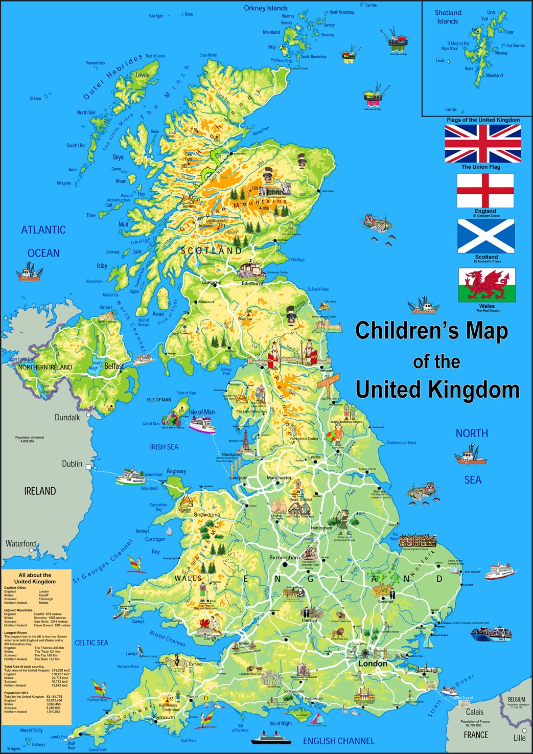
Our Children's Illustrated Map of the United Kingdom is vibrant and informative, with easy-to-read text and bright colours. Including capital cities, rivers, major roadways, towns, surrounding bodies of water and mountain ranges and includes icons of well-known locations throughout the United Kingdom. The physical aspects such as land elevation are clearly showed and makes for an attractive map either for the home, office or school, for display on a wall or for desk work. Size A1 - 59.4 x 84.1 cm. Printed onto high quality poster paper and laminated for durability.
Customer reviews
10 Trustpilot reviews total, with 2 shown at a time.
I wrote to Bigamart's customer support and they accompanied the process of reshipping the item until it finally arrived. I felt a genuine effort to solve the problem till it was finally solved.
The package was here in Australia from England in a few days — so quick! Something was missing and they refunded it straight away. Pretty happy with these guys.
You might also like