Ordnance Survey
⏳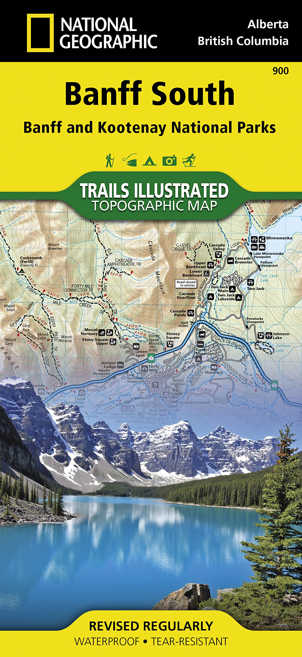
Venture into the breathtaking wilderness of the Canadian Rockies with National Geographic’s Banff South Trails Illustrated Map — your essential companion for outdoor adventures in southern Banff National Park. Covering areas like Lake Louise, Moraine Lake, and Kootenay border trails, this map offers expert topographic detail and trail information for exploring one of Canada’s most scenic alpine regions. Ideal for hiking, backpacking, climbing, and wildlife viewing, this rugged, waterproof map helps you safely navigate trails, backcountry routes, and key park landmarks. Designed with input from park rangers and outdoor professionals, it’s the go-to resource for both casual hikers and seasoned mountaineers. Key Features: Covers Southern Banff National Park: Including Lake Louise, Moraine Lake, Castle Junction, and Kootenay boundary trails. Detailed Topography & Elevation Contours: Plan hikes with terrain awareness. Marked Trails, Campgrounds & Scenic Routes: Great for backpackers, day hikers, and road trippers. Waterproof & Tear-Resistant Construction: Built to withstand mountain weather and repeated use. Includes Park Info & Safety Guidelines: Stay informed and trail-ready. Whether you're climbing to Sentinel Pass or strolling around Bow Lake, the Banff South Trails Illustrated Map is your must-have navigation tool for this stunning section of the Rockies.
Customer reviews
10 Trustpilot reviews total, with 2 shown at a time.
I wrote to Bigamart's customer support and they accompanied the process of reshipping the item until it finally arrived. I felt a genuine effort to solve the problem till it was finally solved.
The package was here in Australia from England in a few days — so quick! Something was missing and they refunded it straight away. Pretty happy with these guys.
You might also like