Gift Republic
✓Educational Charts & Posters
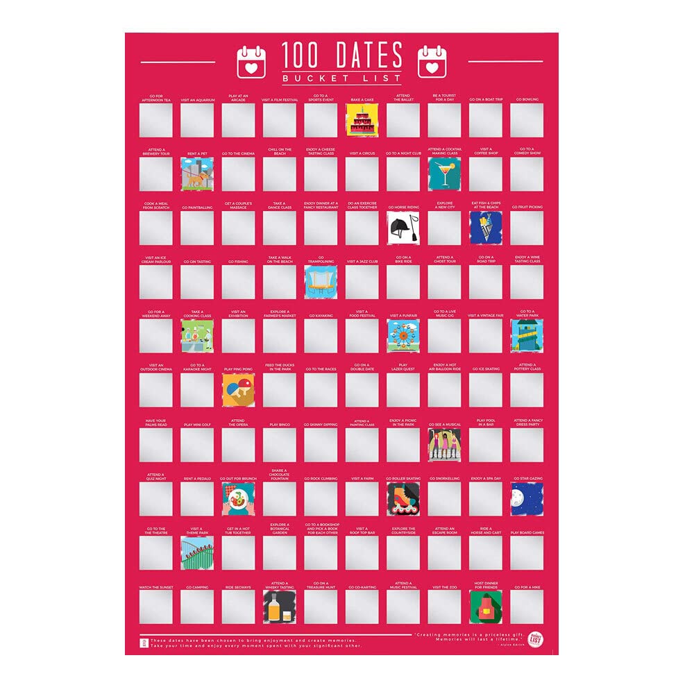
Gift Republic 100 Dates Bucket List Scratch Poster, Pink, A2
★★★★★4.4
$56.99
View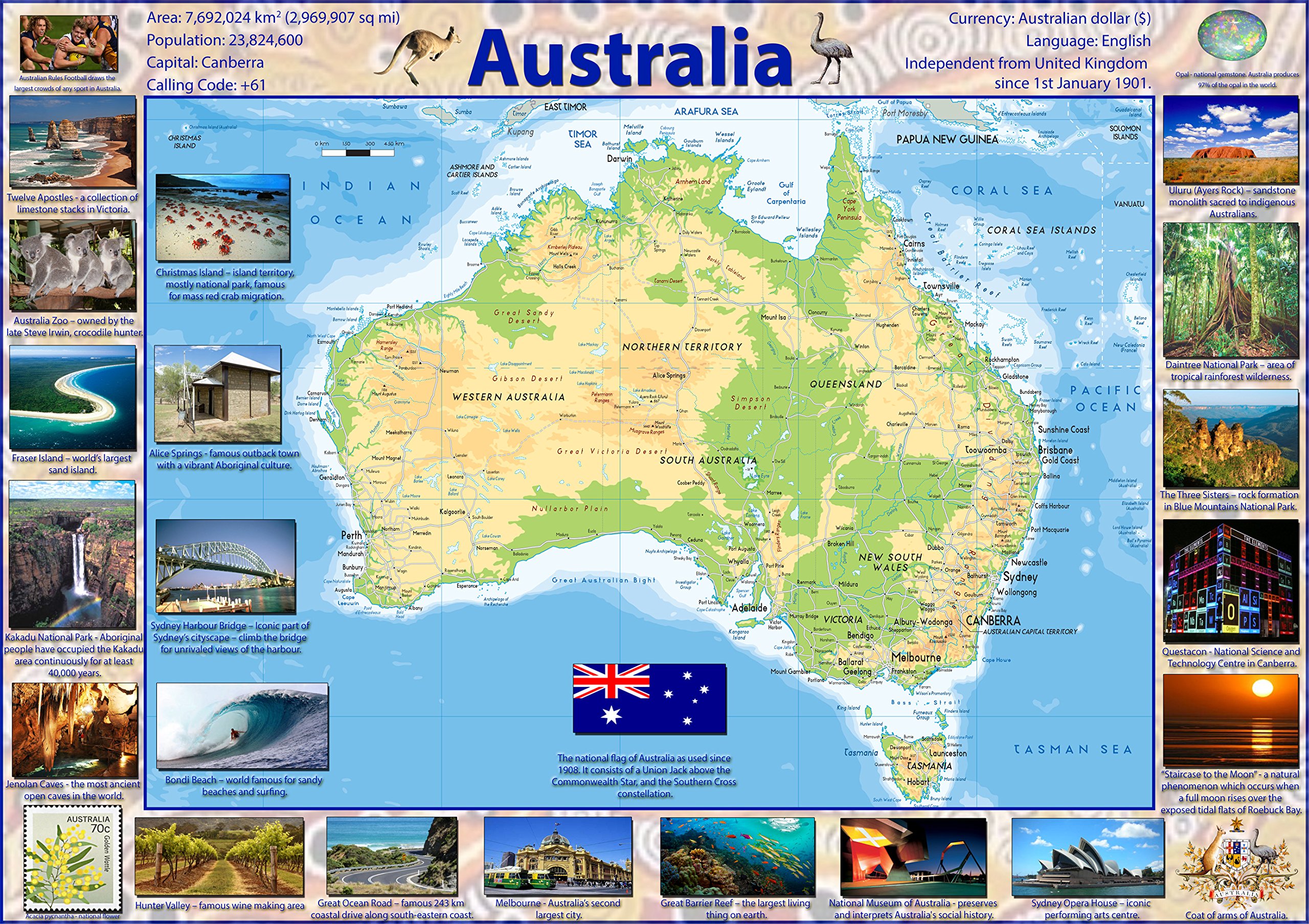
Our Illustrated Map of Australia is vibrant and informative, with easy-to-read text and bright colours. Including capital cities, rivers, major roadways, towns, surrounding bodies of water and mountain ranges and includes images of well-known locations throughout Australia. The physical aspects such as land elevation are clearly showed and makes for an attractive map either for the home, office or school, for display on a wall or for desk work. Size A0 - 84.1 x 118.9 cm. Printed onto high quality poster paper and laminated for durability.
Customer reviews
10 Trustpilot reviews total, with 2 shown at a time.
I wrote to Bigamart's customer support and they accompanied the process of reshipping the item until it finally arrived. I felt a genuine effort to solve the problem till it was finally solved.
The package was here in Australia from England in a few days — so quick! Something was missing and they refunded it straight away. Pretty happy with these guys.
You might also like