๐ŸŒ Worldwide shipping ยท 30-day returns ยท Rated Excellent on Trustpilot โ˜…โ˜…โ˜…โ˜…ยฝ
Price
$52.99
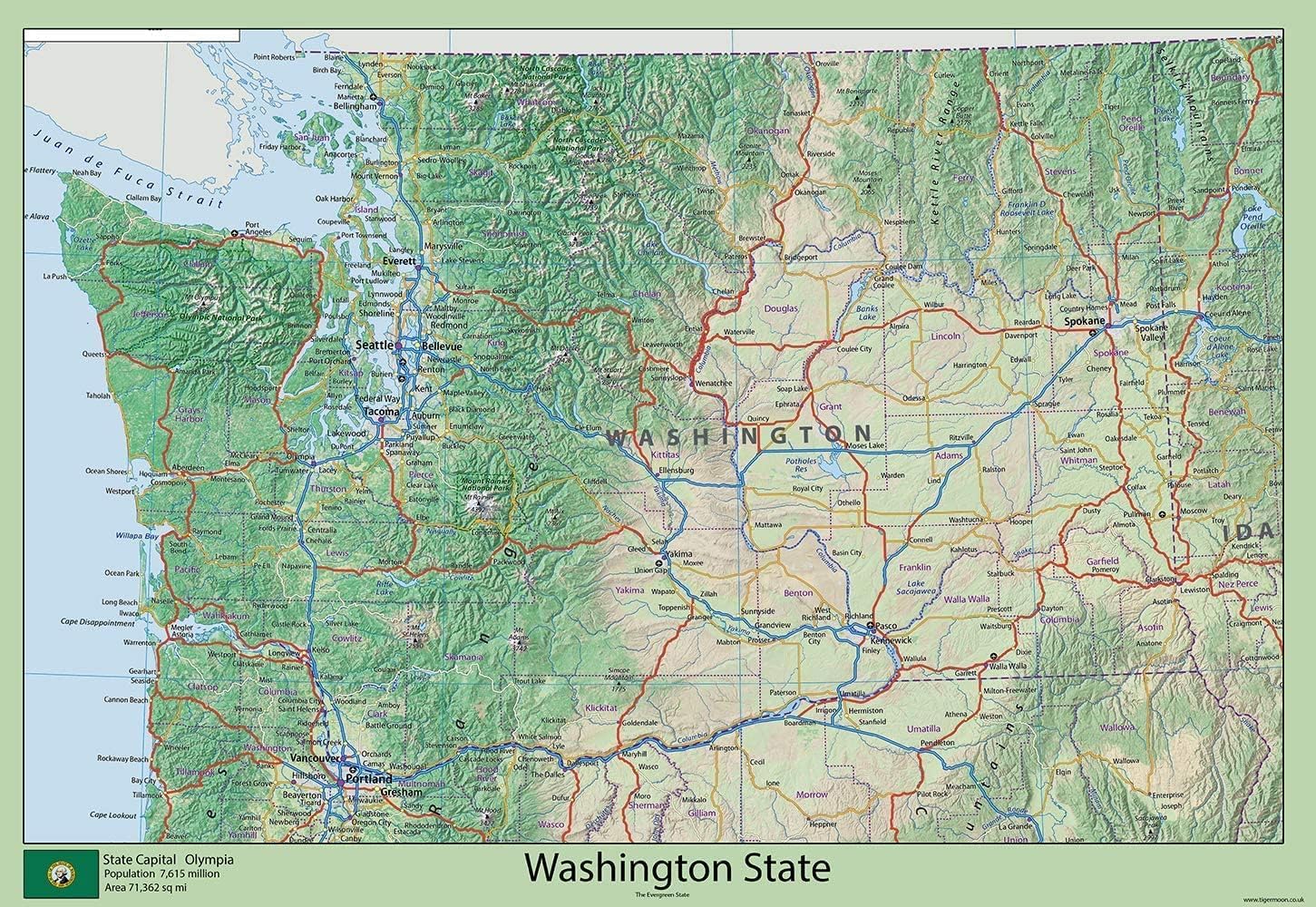
USA State Maps - Washington State Physical Map - Size 59.4 x 40.9 cm - Paper Laminated โ€” image 1
MapsI MAPSโœ“ In stock

USA State Maps - Washington State Physical Map - Size 59.4 x 40.9 cm - Paper Laminated

โ˜…โ˜…โ˜…โ˜…โ˜…
$52.99
Worldwide shipping
Fast tracked delivery
30-day returns
Hassle-free returns
Secure checkout
Safe & protected
Great service
Thousands of happy customers
Add to cart
About this item
  • Explore the capital, Olympia, and cities such as Seattle, Belleview, Tacoma, Vancouver, Yakima, Federal Way, Kent, Kennewick & Pasco. As the 18th largest US state, over 50% of the population is based in Seattle - an incredible center of transportation, business & industry along the beautiful Puget Sound inlet of the Pacific Ocean. Plus, Puget Sound features numerous islands, scenic fjords and bays made from glaciers.
  • Beyond that, you can explore the west's rainforests and a host of mountain ranges, with Mount Rainier. Take in the wonders of the Evergreen State with this full-color map. This physical map presents key information such as the capital cities, population, area size, and largest city, plus locations of airports, major highways, state boundaries, and populated areas. In addition, the map includes bodies of water and points of interest such as national and state parks, forests and more.
  • Size - 59.4 x 40.9 cm. Printed onto high quality poster paper and laminated for extra durability.
Product description

Explore the capital, Olympia, and cities such as Seattle, Belleview, Tacoma, Vancouver, Yakima, Federal Way, Kent, Kennewick & Pasco. As the 18th largest US state, over 50% of the population is based in Seattle - an incredible center of transportation, business & industry along the beautiful Puget Sound inlet of the Pacific Ocean. Plus, Puget Sound features numerous islands, scenic fjords and bays made from glaciers! Beyond that, you can explore the west's rainforests and a host of mountain ranges, with Mount Rainier. Take in the wonders of the Evergreen State with this full-color map. This physical map presents key information such as the capital cities, population, area size, and largest city, plus locations of airports, major highways, state boundaries, and populated areas. In addition, the map includes bodies of water and points of interest such as national and state parks, forests, cultural sites, and more.

Product details
Brand
I MAPS
Manufacturer
Tiger Moon The Tiger Moon Trading Company Ltd
Colour
Blue
Size
59.4 x 40.9 cm
Part number
WASHINGTON-V1

Customer reviews

What customers say about Bigamart

10 Trustpilot reviews total, with 2 shown at a time.

Trustpilot
โ˜…โ˜…โ˜…โ˜…โ˜…
Excellent
4.5 average rating
See all reviews โ†’
S
Sigalit
๐Ÿ‡ฎ๐Ÿ‡ฑ ยท January 2026
โ˜…โ˜…โ˜…โ˜…โ˜…

I wrote to Bigamart's customer support and they accompanied the process of reshipping the item until it finally arrived. I felt a genuine effort to solve the problem till it was finally solved.

V
Verified buyer
๐Ÿ‡ฆ๐Ÿ‡บ ยท November 2025
โ˜…โ˜…โ˜…โ˜…โ˜…

The package was here in Australia from England in a few days โ€” so quick! Something was missing and they refunded it straight away. Pretty happy with these guys.

Showing 1โ€“2 of 10 reviews

You might also like

Similar items

View all โ†’