Little Wigwam
✓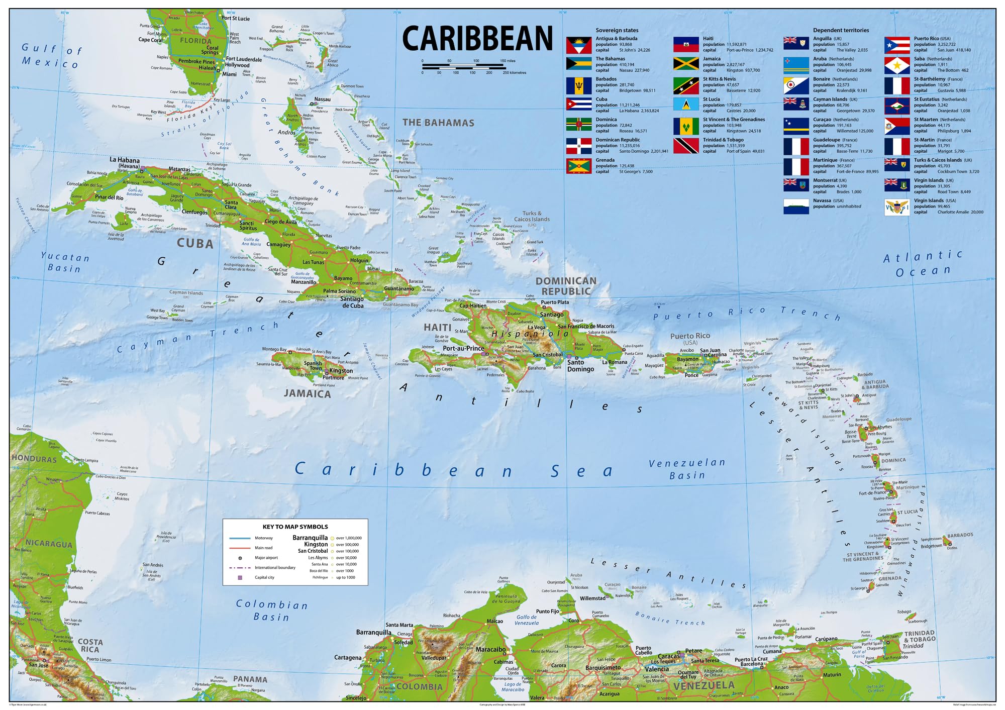
The Caribbean - a vibrant region that includes the Caribbean Sea and its islands, is a subregion of the Americas. Many of these islands are surrounded by the Caribbean Sea and some border both the Caribbean Sea and the North Atlantic Ocean. Our Physical Caribbean map showcases its geography, with easy-to-read text and features like capital cities, rivers, major roads, towns, bodies of water and country flags. It's perfect for any room, office, or school, and a great way to gain a comprehensive view of the area. With many details, you'll get an unparalleled understanding of the Caribbean! Size A2 - 59.4 x 42 cm. Printed onto high quality poster paper and laminated for durability.
Customer reviews
10 Trustpilot reviews total, with 2 shown at a time.
I wrote to Bigamart's customer support and they accompanied the process of reshipping the item until it finally arrived. I felt a genuine effort to solve the problem till it was finally solved.
The package was here in Australia from England in a few days — so quick! Something was missing and they refunded it straight away. Pretty happy with these guys.
You might also like