Little Wigwam
✓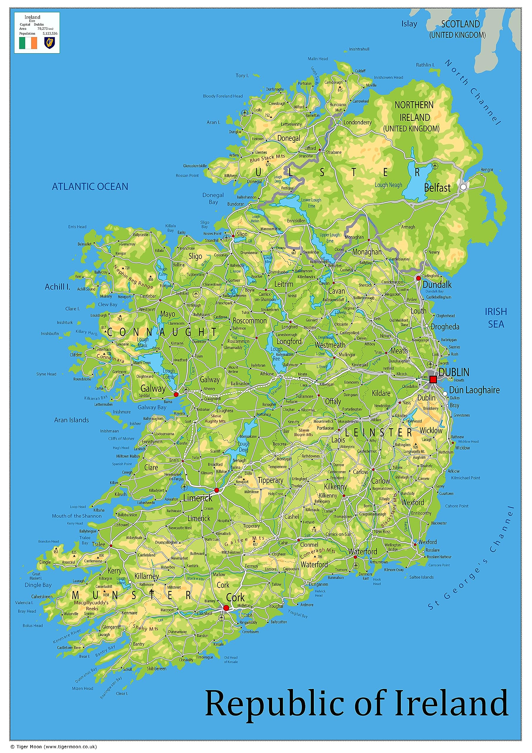
Our Oxford Collection map of Ireland boasts key attributes such as the capital city, population, area size, and main cities. In addition, this physical map shows state lines, highways, and airports, as well as oceans, lakes, and renowned attractions such as national and state parks, forests, and cultural sites. It is a perfect asset for classrooms and an exceptional resource for learning all that the country provides. Size - 42 x 59.4 cm. Printed onto a high quality paper and laminated for durability.
Customer reviews
10 Trustpilot reviews total, with 2 shown at a time.
I wrote to Bigamart's customer support and they accompanied the process of reshipping the item until it finally arrived. I felt a genuine effort to solve the problem till it was finally solved.
The package was here in Australia from England in a few days — so quick! Something was missing and they refunded it straight away. Pretty happy with these guys.
You might also like