Ordnance Survey
⏳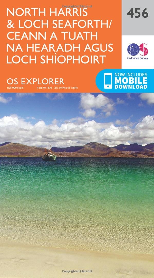
Product Description Blaze a trail on North Harris and around the shores of Loch Seaforth, through some of the remotest, wildest and most magnificent scenery the Outer Hebrides has to offer. Go eagle-spotting at the purpose-built Eagle Observatory or head north from tiny Huisinis to the pristine white sands of Traigh Mheilein, with views over the Island of Scarp. Climb Clisham, the highest mountain in the Outer Hebrides, or seek out an even more stunning view at the overhanging cliff of Sron Uladal Explore remote Loch Crabhadal, offering staggering panoramic views across the Sound to Scarp and the Uig hills of Lewis Walk, hike, cycle and climb amidst the unspoiled beaches, flower-filled meadows and dramatic rocky landscapes of North Harris OS Explorer Maps: 1:25,000 scale (4 cm to 1 km – 2½ inches to 1 mile). Great for walkers, hikers, cyclists, families, dog walkers, and horse riders. Includes roads, rights of way, permissive paths and bridleways, plus essential visitor information. Free digital download included. Other Ordnance Survey Explorer maps of the Outer Hebrides include Rum, Eigg, Muck, Canna & Sanday map 397 and South Harris map 455. Review Select Guide Rating
Customer reviews
10 Trustpilot reviews total, with 2 shown at a time.
I wrote to Bigamart's customer support and they accompanied the process of reshipping the item until it finally arrived. I felt a genuine effort to solve the problem till it was finally solved.
The package was here in Australia from England in a few days — so quick! Something was missing and they refunded it straight away. Pretty happy with these guys.
You might also like