Global Walkabout
✓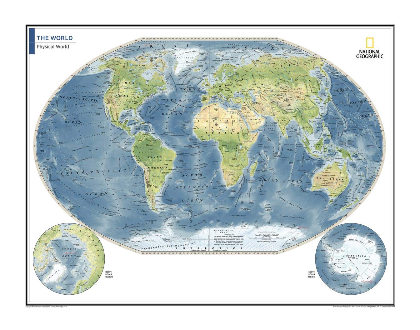
Hang a milestone map on your wall! This world map of physical features can fit in any space, and is featured in the National Geographic Atlas of the World, Tenth Edition , published to mark the 100th anniversary of National Geographic. Showcasing the Earth in stunning detail with state-of-the-art cartographic techniques delivering accuracy and exceptional quality, the innovative and engaging design makes the content easily accessible and user-friendly. Ideal for classrooms with an emphasis on teaching geography or environmental themes. Physical wall maps give your students a genuine feel for how our world appears. The Physical World Map uses a bright, easy to read color palette featuring blue oceans and stunning shaded relief that has been featured on National Geographic wall maps for over 75 years. Drawn in the Winkel Tripel projection, distortions of land masses around the poles are minimized: unlike many other World maps, Greenland is accurately shown as the same size as Argentina and not the size of all of South America. Names of geographic features are carefully placed on the map to maintain legibility. Details include clearly defined features such as fracture zones, ocean ridges, mountains, deserts and plateaus, and key world cities. Corner inset maps feature the north and south polar regions. National Geographic's maps are the standard by which all other reference maps are measured. The maps are meticulously researched and adhere to National Geographic's convention of making independent, apolitical decisions based on extensive research using multiple authoritative sources. This map is found in National Geographic's 10th Edition World Atlas, and is now available as a stand alone product. Printed on high quality thick paper strong enough for display on your wall. Your map is rolled and packaged in a sturdy tube to protect it during shipment.
Customer reviews
10 Trustpilot reviews total, with 2 shown at a time.
I wrote to Bigamart's customer support and they accompanied the process of reshipping the item until it finally arrived. I felt a genuine effort to solve the problem till it was finally solved.
The package was here in Australia from England in a few days — so quick! Something was missing and they refunded it straight away. Pretty happy with these guys.
You might also like