Little Wigwam
✓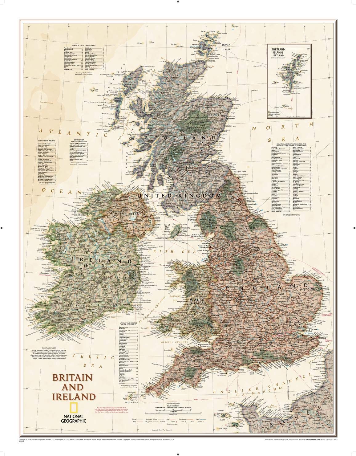
National Geographic's Executive political map of Britain and Ireland is both an attractive addition to any study or classroom and an informative tool for exploring these fascinating countries. The map features thousands of place names, major highways and roads, airports, ferry routes, bodies of water, and more. Handy indexes make it easy to identify the counties, districts, council areas, unitary authorities, and metropolitan districts of Ireland, Northern Ireland, Scotland, Wales, and England. An inset provides detail of the Shetland Islands. National parks are clearly indicated in green vignettes, and shaded relief reveals the interesting and varied topography of these island nations. English and Gaelic (Irish) share official status per the Republic of Ireland's constitution, so place names are rendered in both. In the Gaeltachtl, or predominantly Irish-speaking regions, only Irish place-names have official status and are used on signposts. These districts are found within the counties of Cork, Donegal, Galway, Kerry, Mayo, Meath, and Waterford. Printed on thick paper suitable for display on your home, school or office wall. Your map is rolled and packaged in a sturdy tube to protect it during shipment.
Customer reviews
10 Trustpilot reviews total, with 2 shown at a time.
I wrote to Bigamart's customer support and they accompanied the process of reshipping the item until it finally arrived. I felt a genuine effort to solve the problem till it was finally solved.
The package was here in Australia from England in a few days — so quick! Something was missing and they refunded it straight away. Pretty happy with these guys.
You might also like