Global Walkabout
✓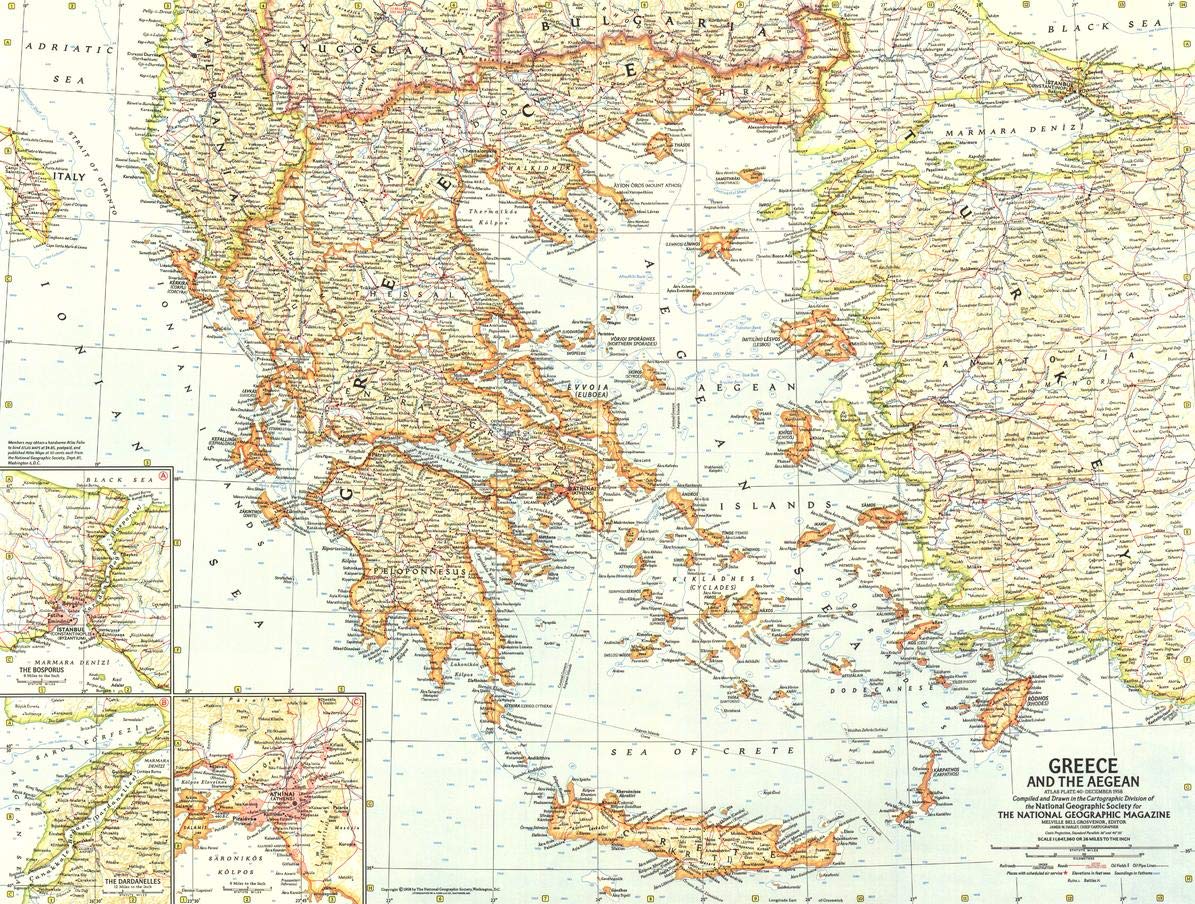
"A map as old as Homer's Troy yet as new as the Greek atomic research center near Athens. From Greece have come some of man's most precious possessions - free speech, free thought and the very word "democracy". Published in December 1958 with the article "The Aegean Isles: Poseidon's Playground," this map of Greece and the Aegean is an unsurpassed example of National Geographic's mid-century cartography. Featuring wonderful detail of the many islands in the region, this map features a plethora of three-dot symbols marking the sites of iconic ancient ruins, such as Homer's fabled Troy. Famous battles are also identified on this map, such as the storied battles of Marathon and Thermopylae. Juxtaposed against the remnants of the past are pipelines, oil fields, airports and a quickly growing network of roads and railways that hint at the modern reality of Greece. Insets of Athens, the Dardanelles - where the First World War Battle of Galipoli was fought - and the Bosporus - where Turkey's mighty Istanbul lives - provide added detail to a region so rich in history and so influential on the world around it in all four cardinal directions. This map is drawn in a Conic projection, in which an area of the earth is projected onto a cone whose vertex is usually above one of the poles, then unrolled onto a flat surface. This map is a unique conversation piece on its own or with other 20th century works: track the evolution of National Geographic's legendary cartography! Printed on high quality thick paper strong enough for display on your wall. Your map is rolled and packaged in a sturdy tube to protect it during shipment.
Customer reviews
10 Trustpilot reviews total, with 2 shown at a time.
I wrote to Bigamart's customer support and they accompanied the process of reshipping the item until it finally arrived. I felt a genuine effort to solve the problem till it was finally solved.
The package was here in Australia from England in a few days — so quick! Something was missing and they refunded it straight away. Pretty happy with these guys.
You might also like