Little Wigwam
✓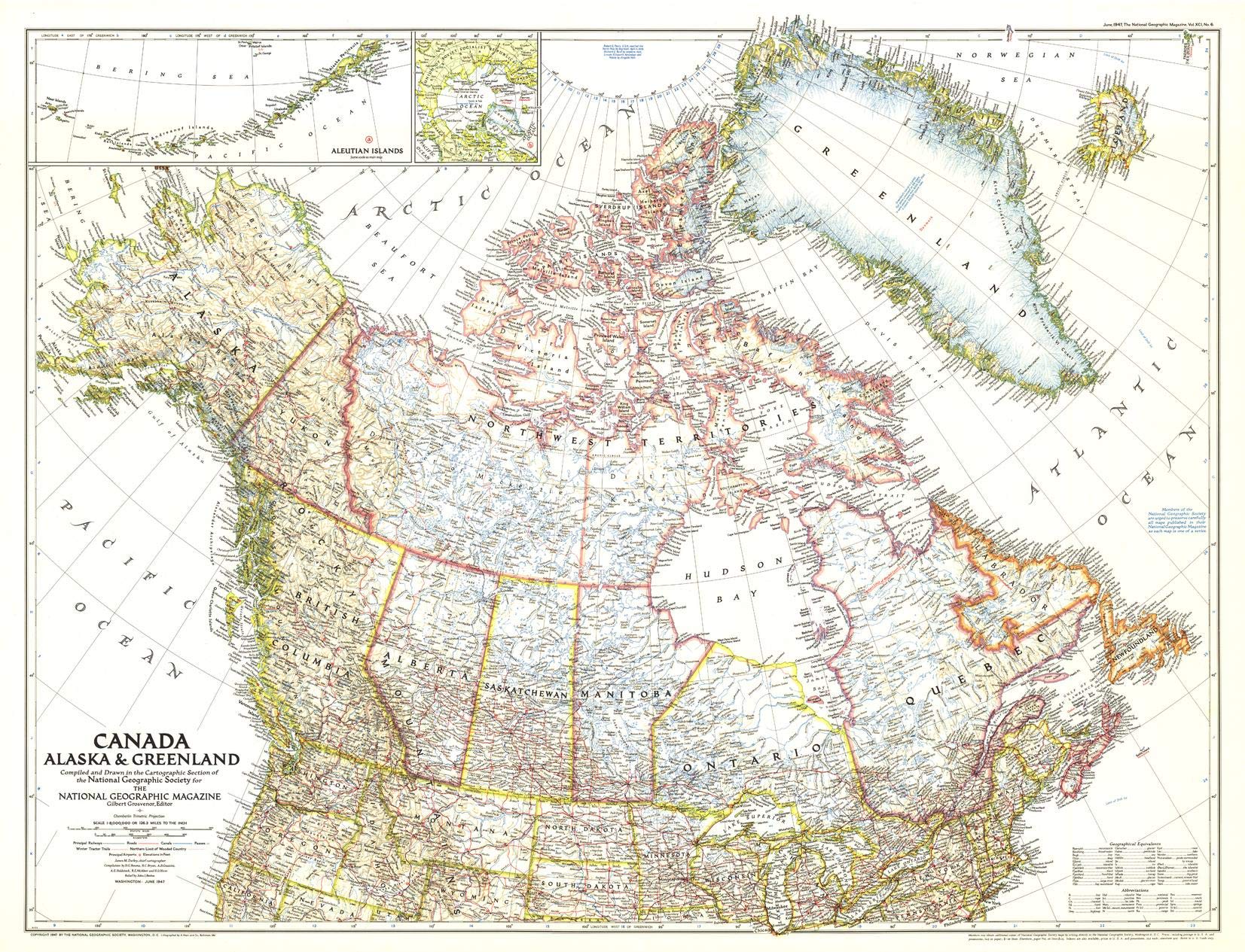
"With the advent of giant modern aircraft, it has become important to show the whole vast top of the Western World." The detailing of this regional map reflects new geographic knowledge; the explosion of technological innovation during and following World War II opened up cartography - and the way that everything was run. Insets of the North Pole and Aleutian Islands are included, offering the economists, statesmen and businessmen a complete picture of the North. Aviation innovation with heavy bombers and other purpose-specific airplane designs now made it possible for regular, safe and reliable air travel to and around the northern reaches of the Western Hemisphere. Could goods and people now be transported over the North Pole? This map was one of the first to be drawn in the Chamberlin Trimetric projection; cartographer Wellman Chamberlin had developed this method just one year earlier in 1946. In this projection, three points are fixed on the globe and the points on the sphere are mapped onto a plane by triangulation. Chamberlin's projection solved the new issue of mapping the polar regions of the planet as an integrated whole without distortion or variations in scale. Never before had these northern areas been mapped with such precision. A must have for map collectors: track the evolution of National Geographic's legendary cartography and of political boundaries with companion pieces from the 1930s to the modern day! Your laminated map has a glossy finish so that you can use dry erase markers on the map to highlight features, make plans, and share unique information with others. Lamination is also extremely durable, resistant to folding or ripping. Your map is rolled and packaged in a sturdy tube to protect it during shipment.
Customer reviews
10 Trustpilot reviews total, with 2 shown at a time.
I wrote to Bigamart's customer support and they accompanied the process of reshipping the item until it finally arrived. I felt a genuine effort to solve the problem till it was finally solved.
The package was here in Australia from England in a few days — so quick! Something was missing and they refunded it straight away. Pretty happy with these guys.
You might also like