Global Walkabout
✓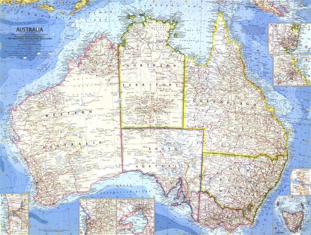
"Geographers invented Australia long before the first Europeans discovered it. In a spinning world, they reasoned, such a land mass had to exist - to balance the great weight of the Northern Hemisphere. So they put it on the map." Published in September 1963, this map of Australia accompanied the articles "The Settled East, the Barrier Reef, the Center," and "Australia on Maps - Old and New." Explore the diverse ecosystems of the Australian continent with this attractive and detailed mid-century map. National Geographic's legendary cartographic style is evident in this map, which features recognizable coloring and typography. Australia's six states are highlighted with bright colored boundaries that only seem to accentuate the contrast between the remote Outback and the populated coastal regions. Insets of the most populous cities of Perth, Adelaide, Melbourne, Sydney and Brisbane are included on this map, as well as insets of Tasmania and of Australia's capital city, Canberra. This map is drawn in the Chamberlin Trimetric projection, where three points are fixed on the globe and the points on the sphere are mapped onto a plane by triangulation. This projection method was developed in 1946 by Wellman Chamberlin, who would become National Geographic's chief cartographer in 1964. This vintage map is truly a unique conversation piece. The mid-century coloring and style makes it a must have for any decor. Historians of Australia will love this beautiful production. It makes a fine companion to the 1948 map of Australia. Your laminated map has a glossy finish so that you can use dry erase markers on the map to highlight features, make plans, and share unique information with others. Lamination is also extremely durable, resistant to folding or ripping. Your map is rolled and packaged in a sturdy tube to protect it during shipment.
Customer reviews
10 Trustpilot reviews total, with 2 shown at a time.
I wrote to Bigamart's customer support and they accompanied the process of reshipping the item until it finally arrived. I felt a genuine effort to solve the problem till it was finally solved.
The package was here in Australia from England in a few days — so quick! Something was missing and they refunded it straight away. Pretty happy with these guys.
You might also like