Gift Republic
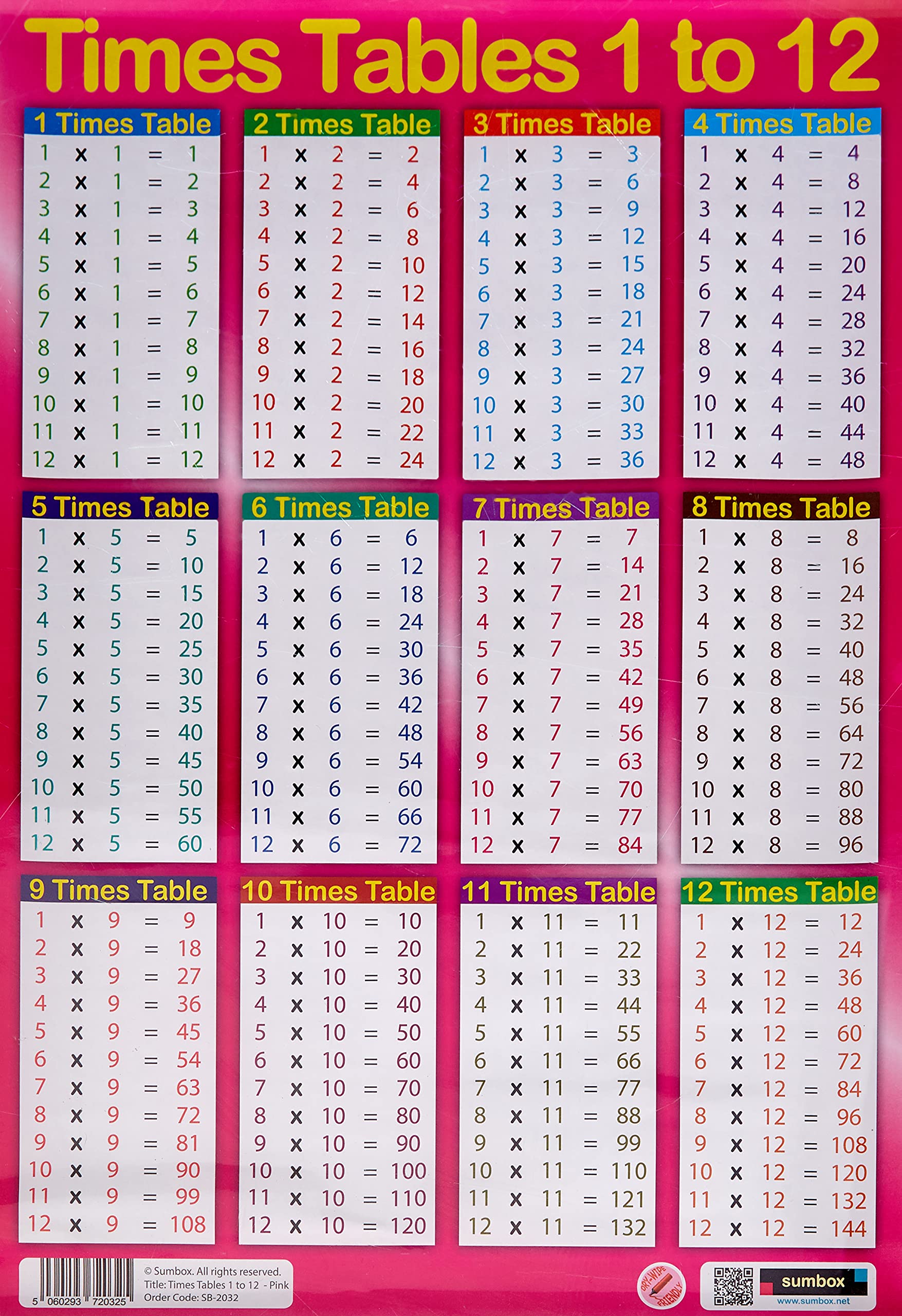
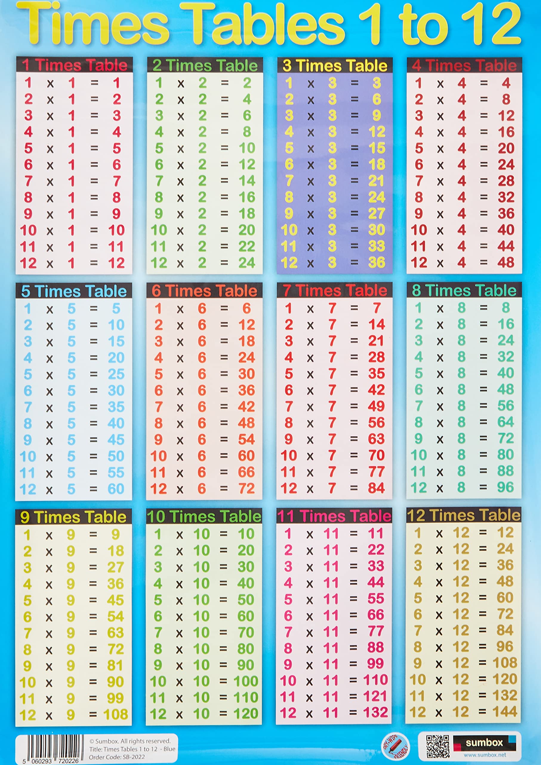
✓Educational Charts & Posters
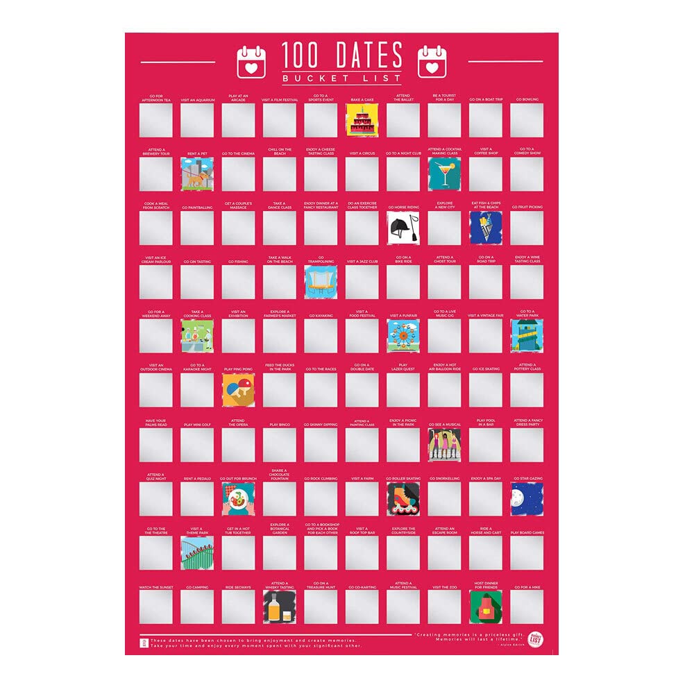
Gift Republic 100 Dates Bucket List Scratch Poster, Pink, A2
★★★★★4.4
$56.99
View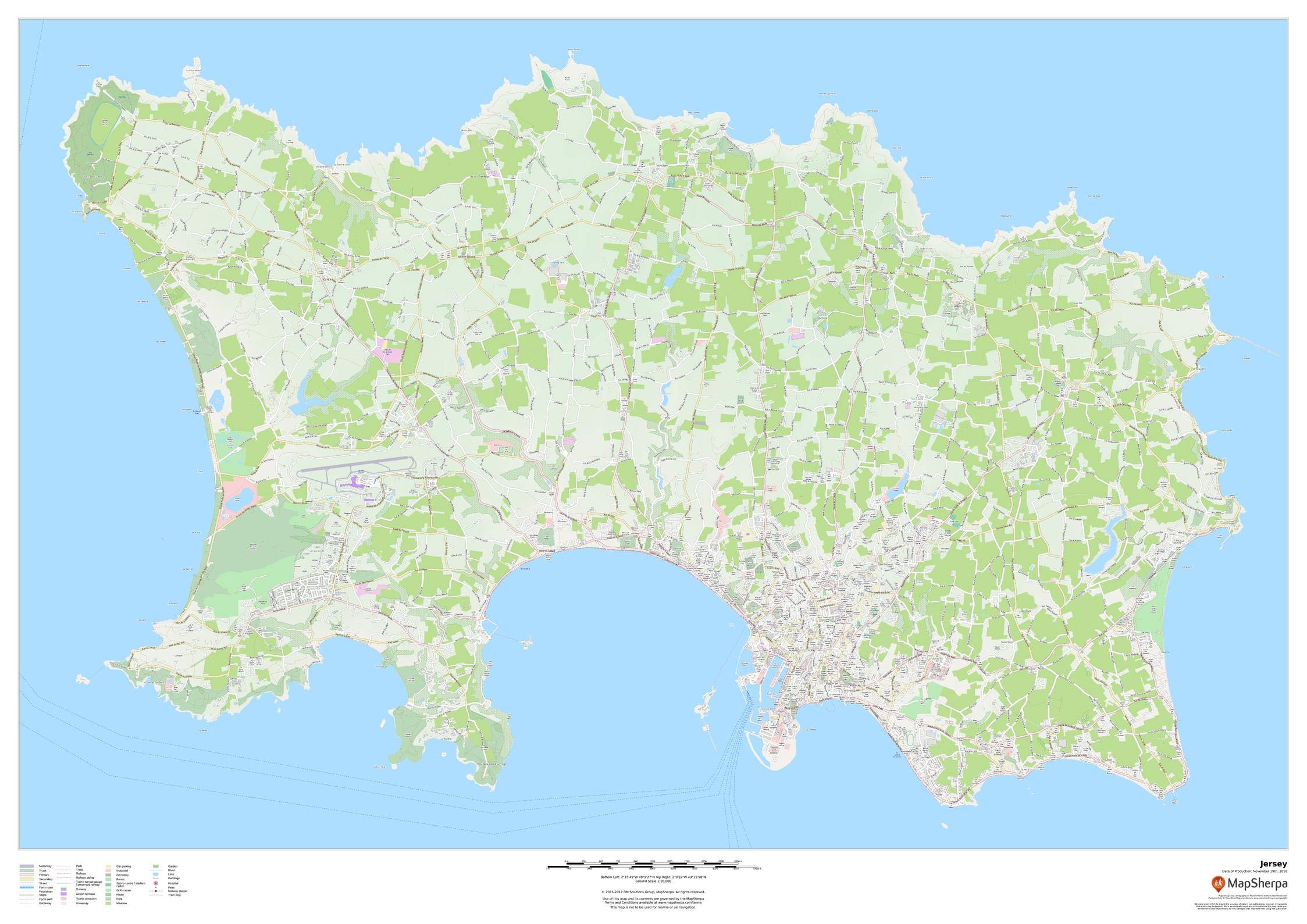
47 x 33.25 inches. Printed on paper. Flat map, tubed for shipping. This wall map of Jersey in the Channel Islands features a clean design and rich detail designed for the traveller. Street mapping of the capital Saint Helier is included, along with land use, points of interest, and many of the building outlines. Walking paths throughout the island are displayed to assist with the local visitor. Scale 1:16,000
Customer reviews
10 Trustpilot reviews total, with 2 shown at a time.
I wrote to Bigamart's customer support and they accompanied the process of reshipping the item until it finally arrived. I felt a genuine effort to solve the problem till it was finally solved.
The package was here in Australia from England in a few days — so quick! Something was missing and they refunded it straight away. Pretty happy with these guys.
You might also like