Little Wigwam
✓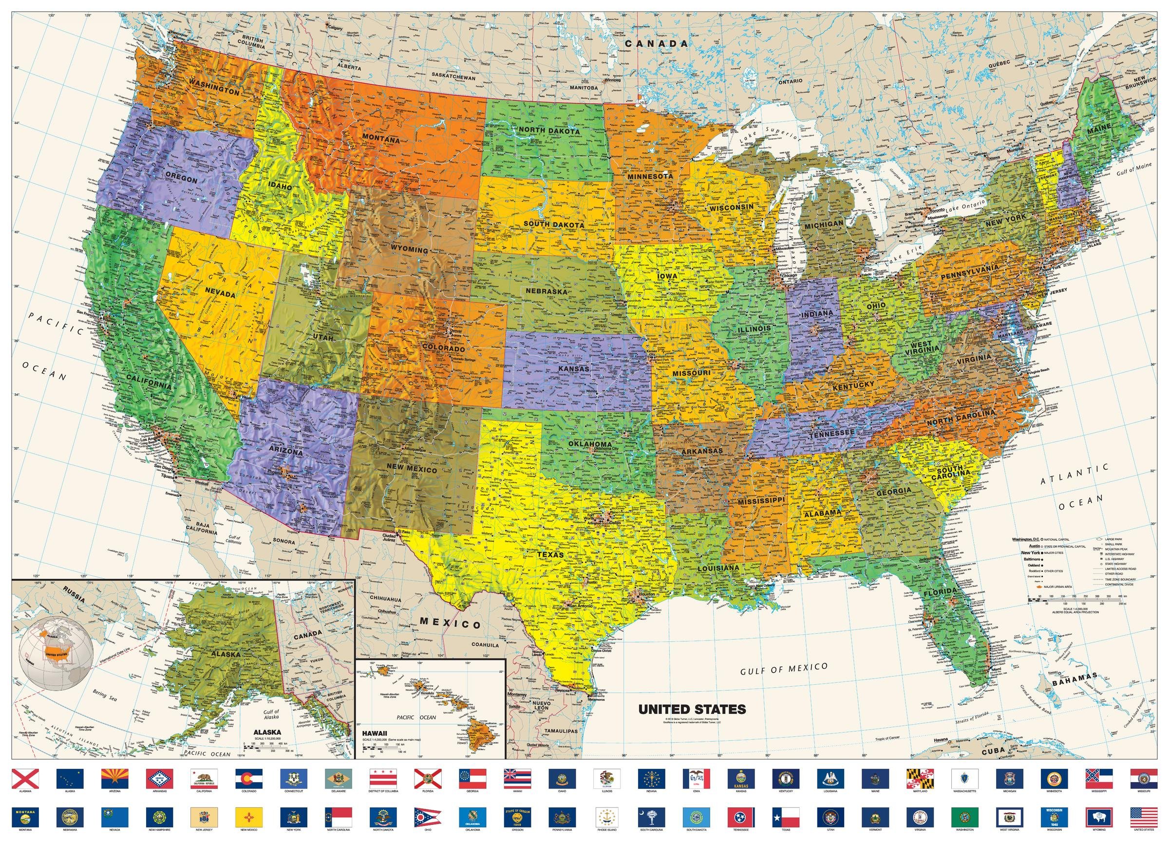
50 x 36 inches. Printed on polypropylene. The material is stronger than most papers and unlikely to crease or rip. The matte finish eliminates glare, and adds texture to the map. Ideal for display. Please note this map is NOT laminated - the page is not appropriate for dry-erase markers. Flat map, tubed for shipping. Perfect for home, business, or school, this Contemporary USA Wall Map with Flags combines bright, attractive colors with high-detailed cartography. Details on this United States Wall Map include: state boundaries and capitals along with other major cities and towns; major physical features such as mountain ranges and major mountain peaks; major water features such as oceans, seas, gulfs, and rivers; the Interstate highway system and other major roads; all National Parks as well as other large National Park Service sites; and flags of all 50 states and the District of Columbia. Special features include ivory-colored oceans and a white decorative border. This map of the United States uses the Albers Equal Area projection. Created by Globe Turner, one of the leading producers of map products in the USA. Scale 1:4,000,000
Customer reviews
10 Trustpilot reviews total, with 2 shown at a time.
I wrote to Bigamart's customer support and they accompanied the process of reshipping the item until it finally arrived. I felt a genuine effort to solve the problem till it was finally solved.
The package was here in Australia from England in a few days — so quick! Something was missing and they refunded it straight away. Pretty happy with these guys.
You might also like