Swiftmaps✓MapsEurope Wall Map Laminated GeoPolitical Edition by Swiftmaps A2 (42cm x 60cm)★★★★★4.6$53.99View
Swiftmaps⏳MapsSouth America Wall Map Laminated GeoPolitical Edition by Swiftmaps A2 (42cm x 60cm)$53.99View
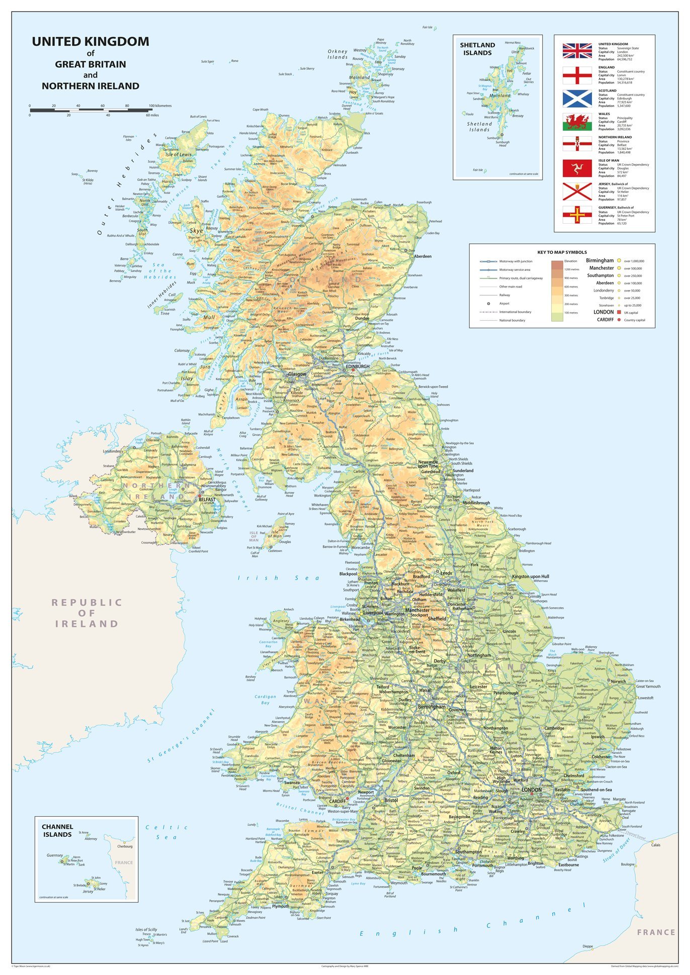
Tiger Moon The Tiger Moon Trading Company Ltd⏳MapsPhysical Map of the United Kingdom of Great Britain and Northern Ireland - Size 100 x 70 cm - Paper Laminated$80.99View
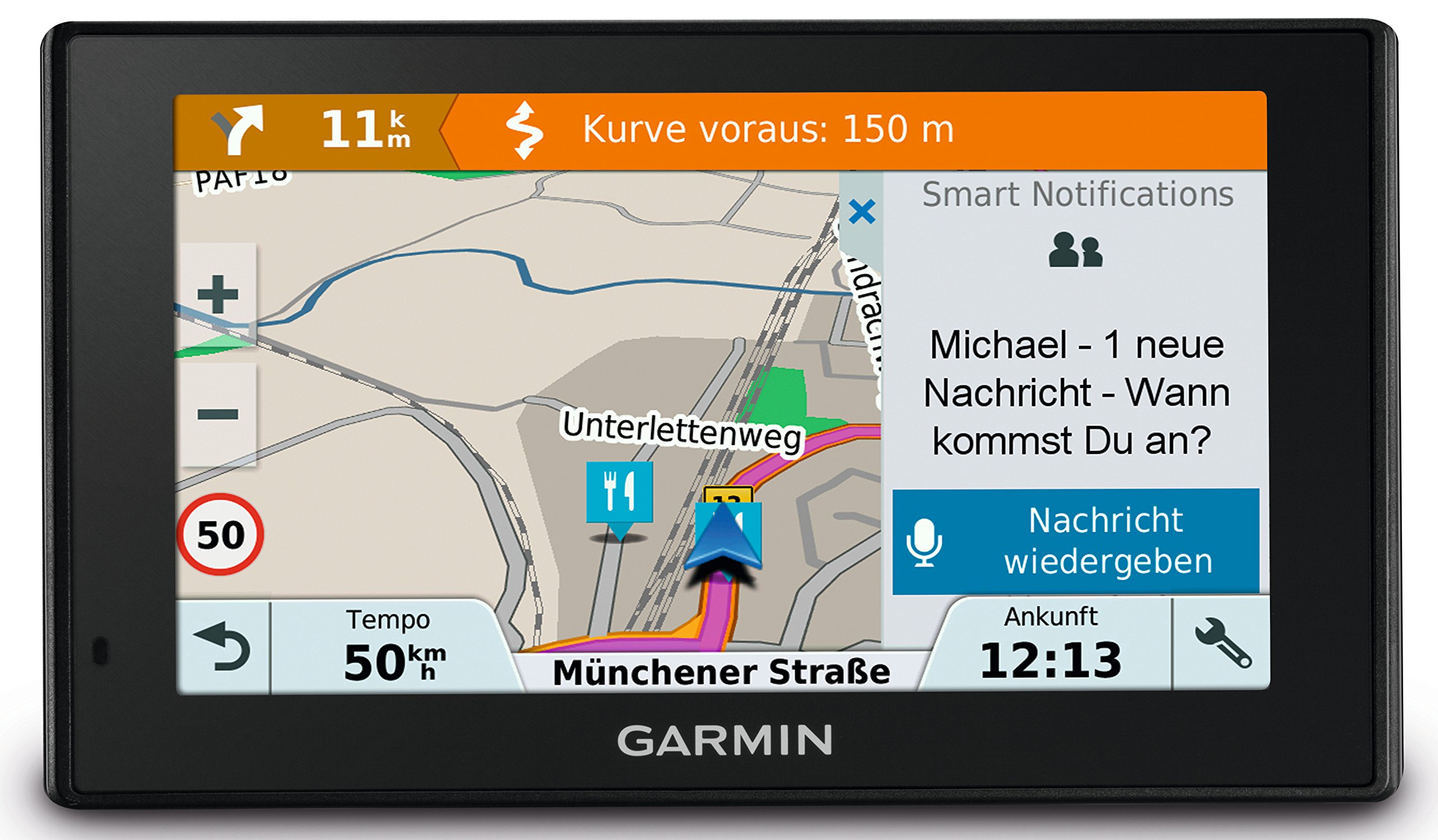
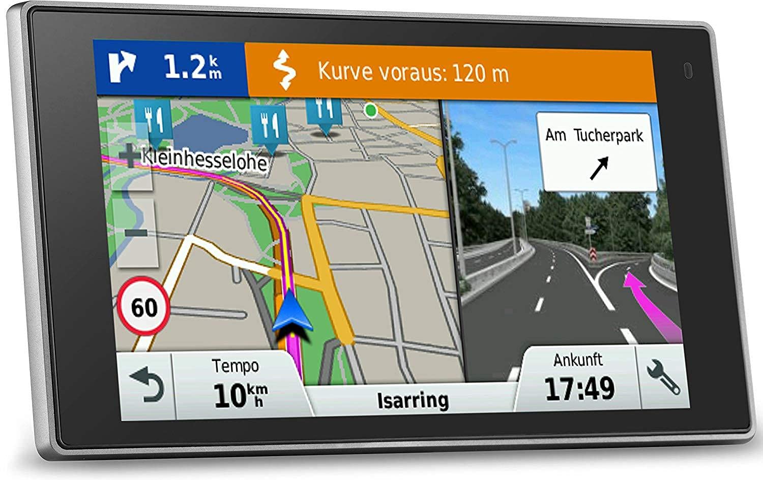
Garmin⏳MapsGarmin DriveSmart navigation device touch display, map updates & traffic information, smart notifications$1205.99View
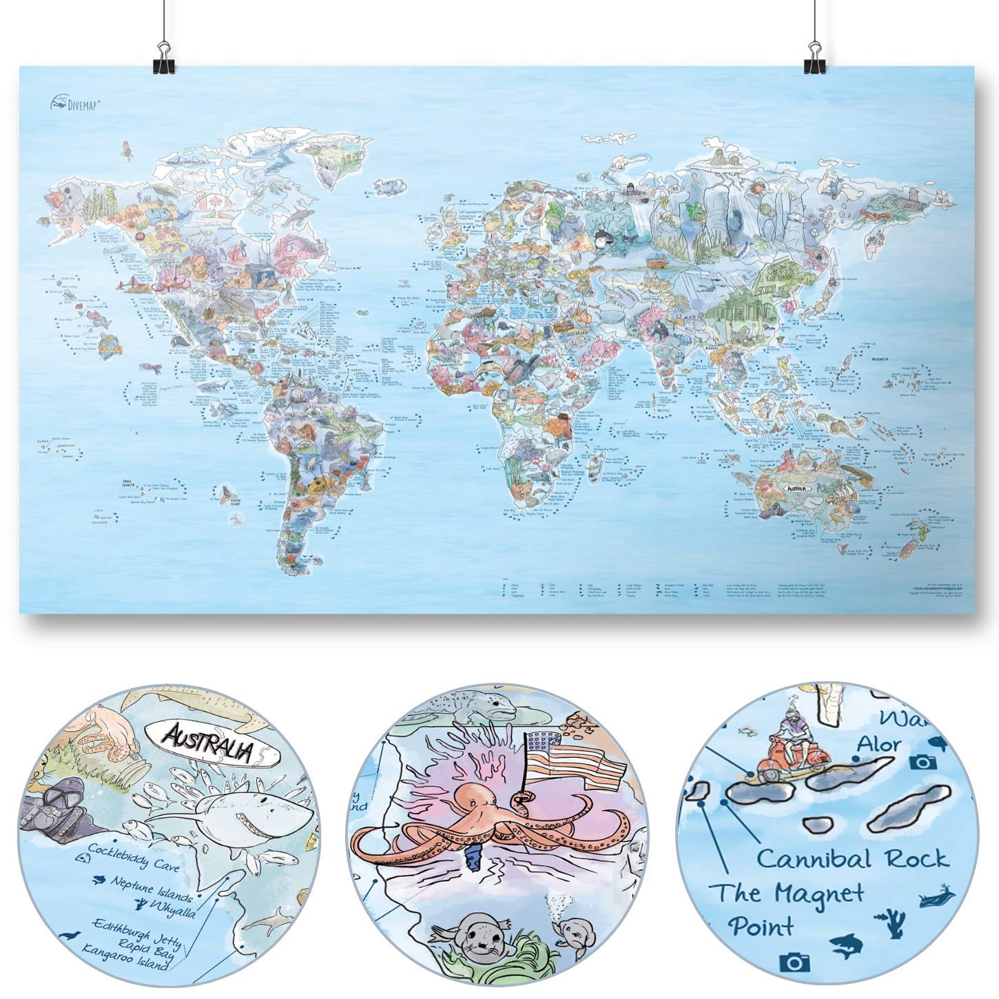
Awesome Maps⏳MapsDive Map | AWESOME MAPS | Discover the Worlds Top 300 spectacular Dive Spots - 97.5 x 56 cm$128.99View
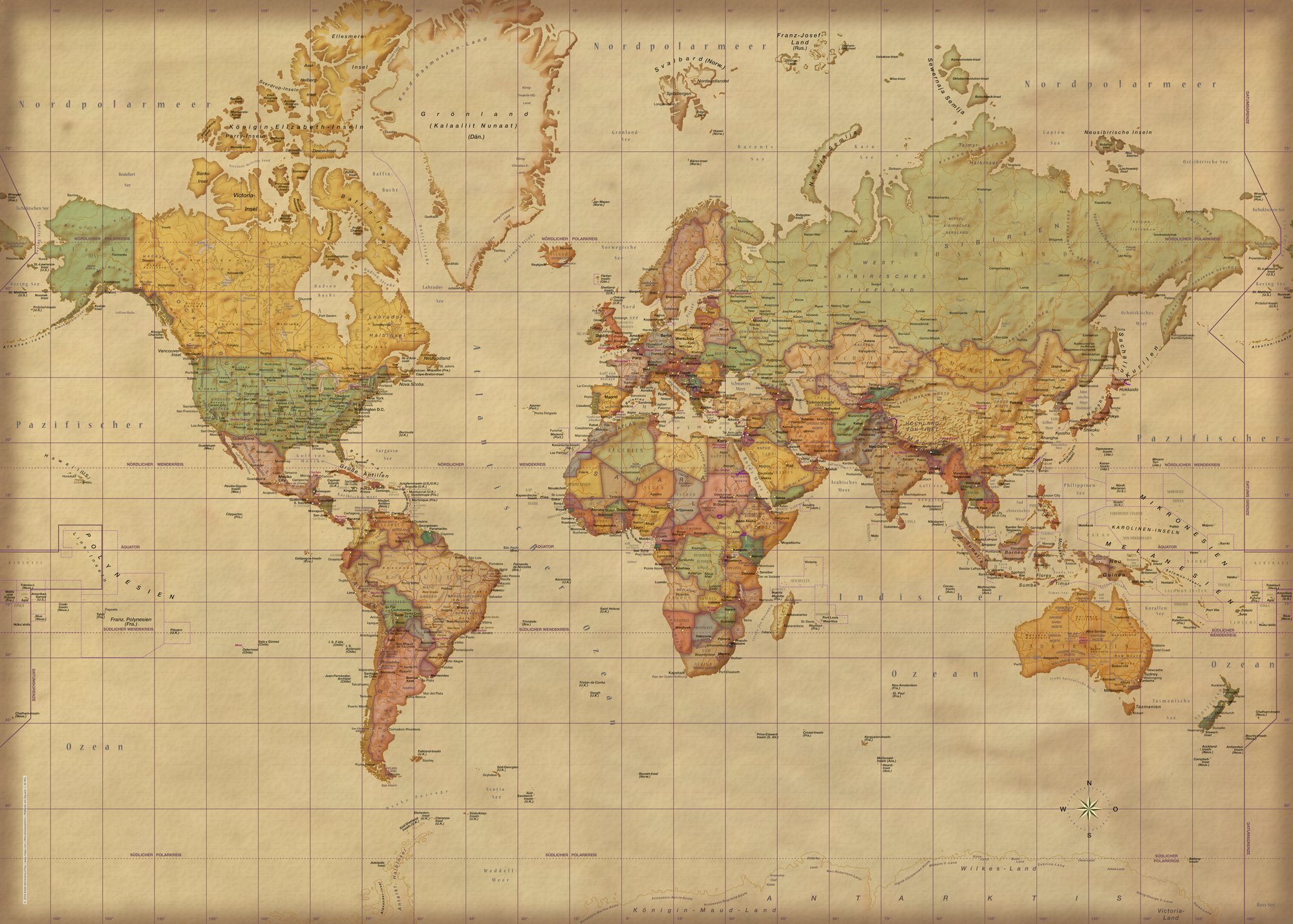
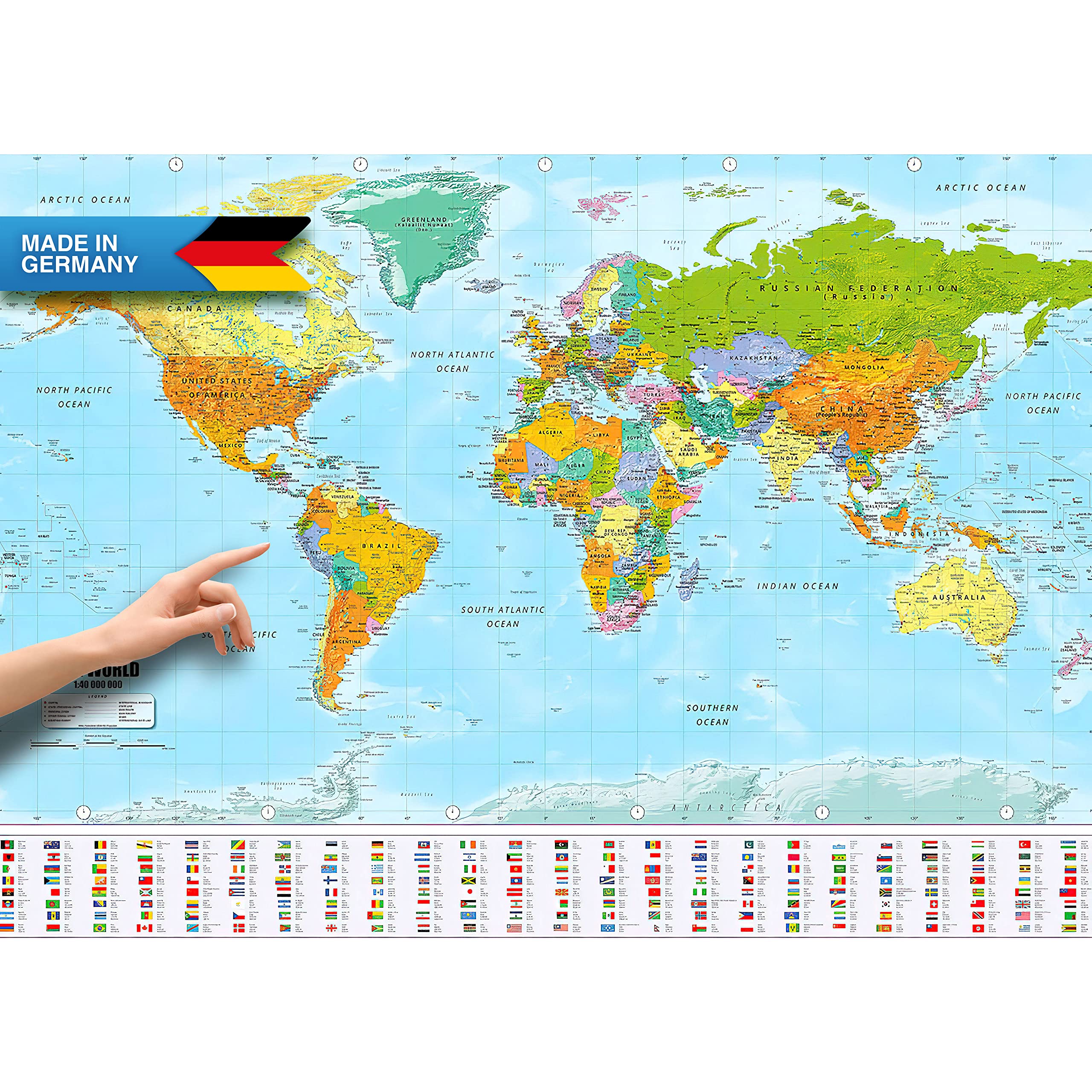
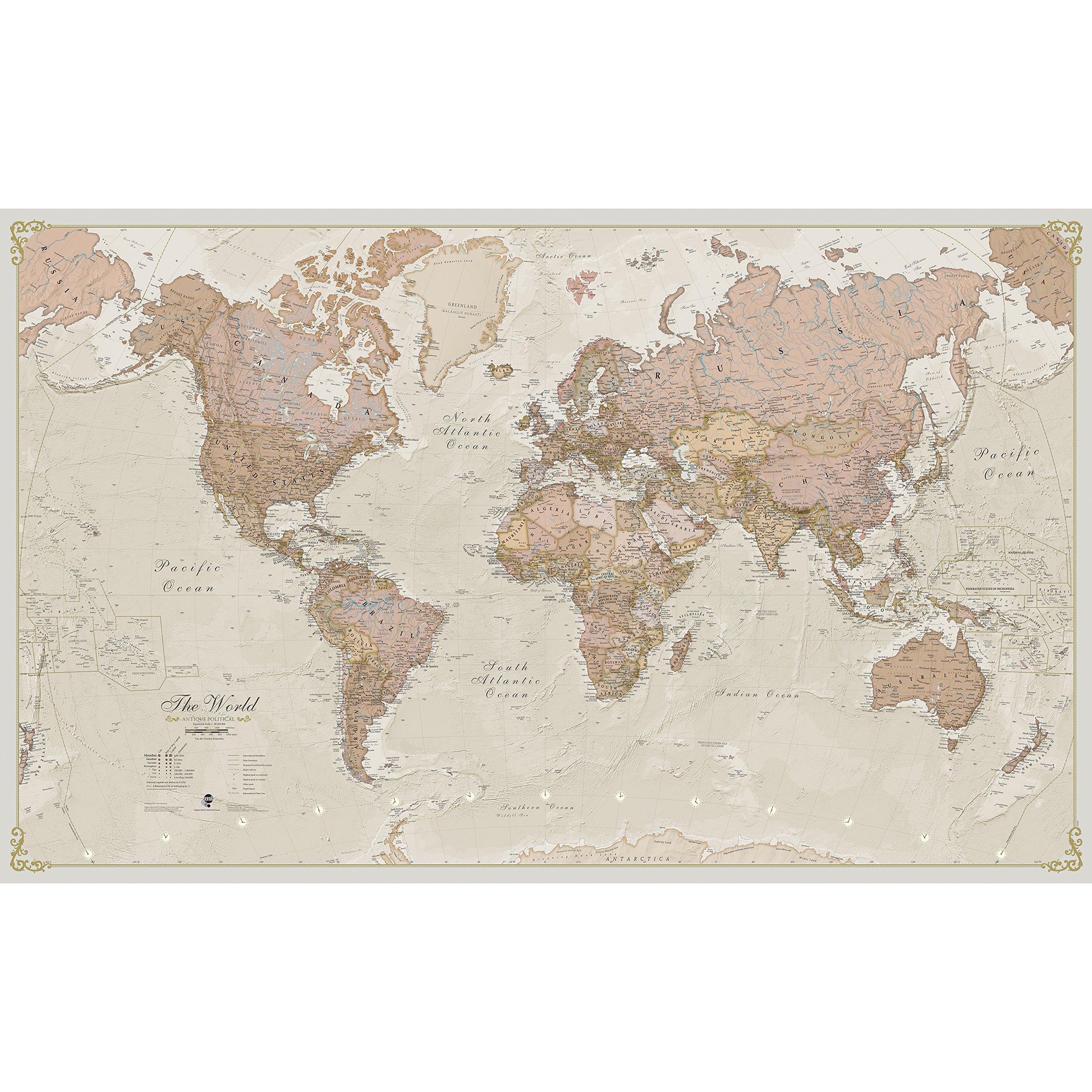
empireposter⏳MapsMap Giant XXL Poster - World Map Antique German Version - Educational Poster 1:30 Million - 140 x 100 cm - Vintage World Map German Version$106.99View
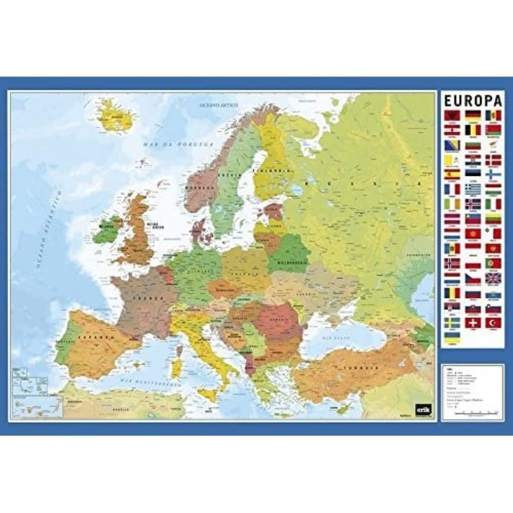
Grupo Erik⏳MapsGrupo Erik Europe Map Desk Mat in Portuguese | 13.5 x 19.5 inches - 34.5 x 49.5 cm Pad Desk Protector Mat | Cute Stationery, Back to School Supplies$38.99View
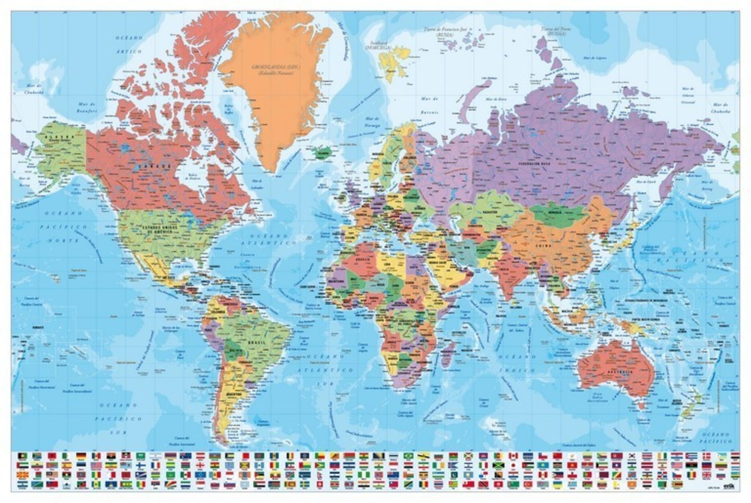
Grupo Erik⏳MapsGrupo Erik World Map Poster - 36 x 24 inches / 91.5 x 61 cm - Shipped Rolled Up - Cool Posters - Art Poster - Posters & Prints - Wall Posters$33.99View
1DEA.me⏳Maps1DEA.me Small Scratch Off Travel World Map - Premium Edition - 23.6" x 15.8" - Rewritable Places I’ve Been Travel Map - US States Outlined - Made From Flexible Plastic to Last Longer (MW)$115.99View
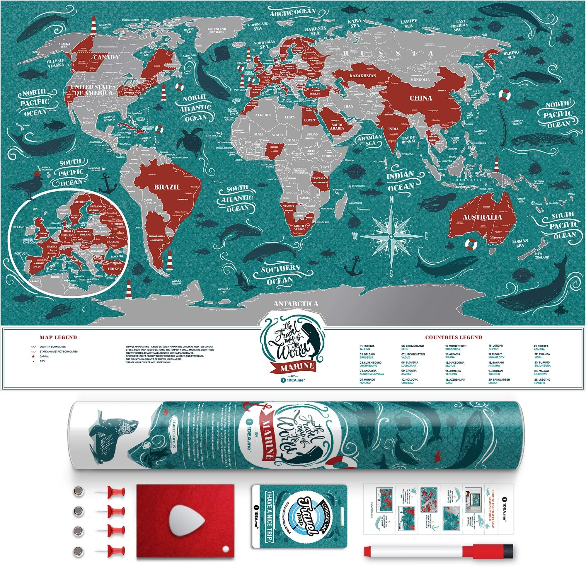
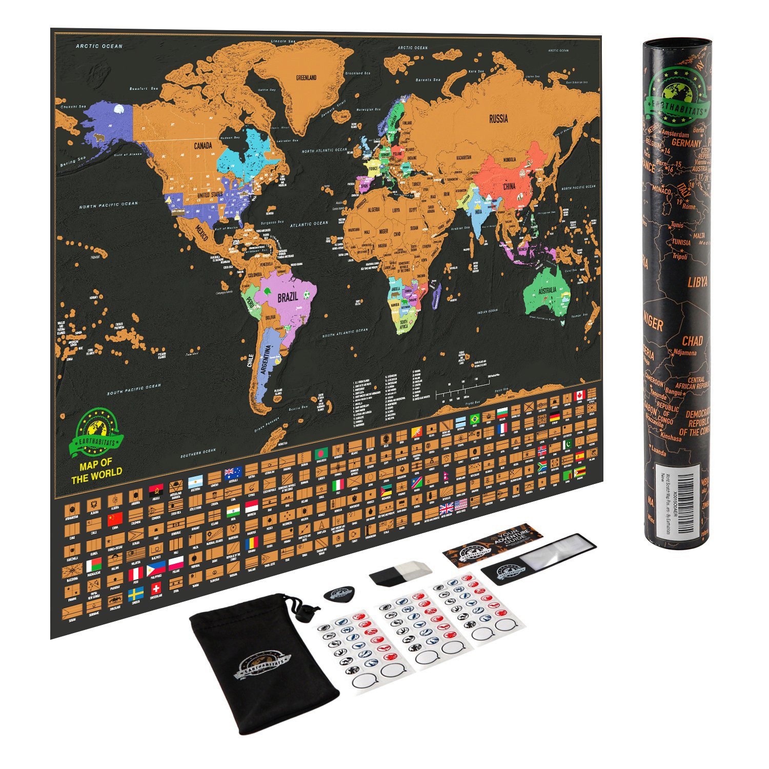
Earthabitats⏳MapsScratch Off Map of The World – Deluxe Travel Map with US States and Country Flags, Full Accessories Set, Most Vibrant Colors, Tracks Where You Have Been, for Travelers, by Earthabitats$95.99View
Maps International⏳MapsScratch Off Europe Edition Poster – Most Detailed Cartography - 59 x 84 cm$57.99View
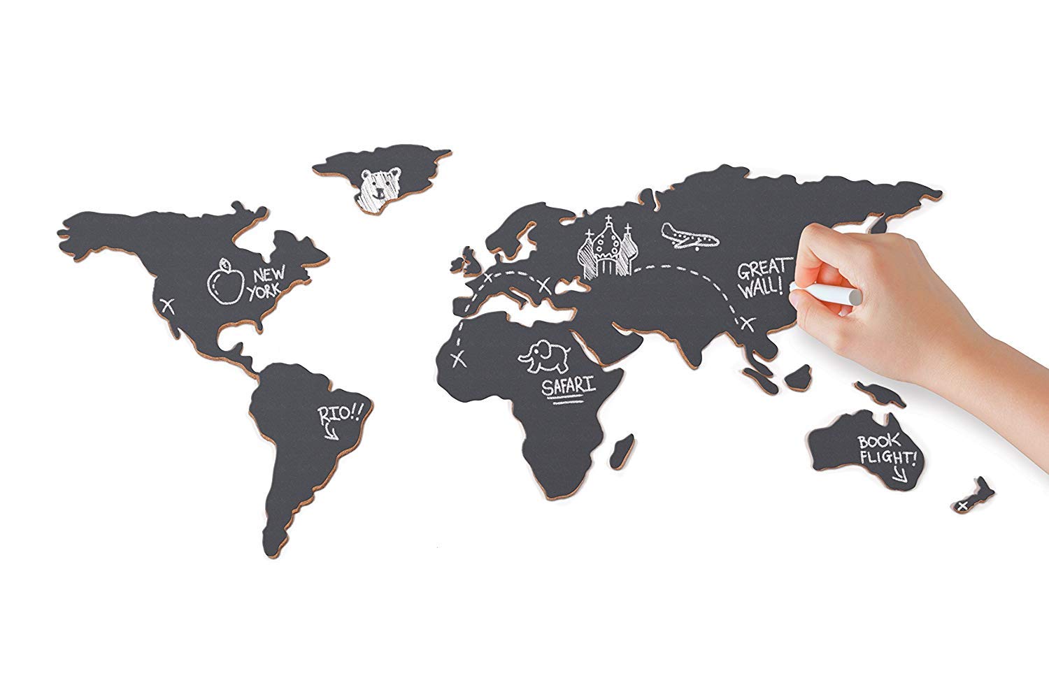
Luckies⏳MapsChalkboard Map - Self Adhesive Map With Chalk, Travel Gift - Luckies of London$134.99View
Grupo Erik⏳MapsGrupo Erik Editores – 10 Pack World Maps, 32.4 x 22.5 cm (English Language not Guaranteed) Physical and Political Map of South America 32.4 x 22.5 cm$12.99View
Grupo Erik⏳MapsGrupo Erik Editores – 10 Pack World Maps, 32.4 x 22.5 cm (English Language not Guaranteed) Political Physical 32.4 x 22.5 cm$19.99View